place

Pergamon

Ancient Greek archaeological sites in TurkeyArchaeological sites in the Aegean RegionAsia (Roman province)Bergama DistrictBuildings and structures in İzmir Province
Former kingdomsFormer populated places in TurkeyHistory of TurkeyHistory of İzmir ProvinceNew Testament citiesPergamonPopulated places in ancient AeolisPopulated places in ancient MysiaTourist attractions in İzmir ProvinceWorld Heritage Sites in Turkey
Acropolis Bergama (Pergamon) Turkey 10 (5747249729)

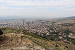
Pergamon or Pergamum ( or ; Greek: Πέργαμον), also referred to by its modern Greek form Pergamos (Πέργαμος), was a rich and powerful ancient Greek city in Mysia. It is located 26 kilometres (16 mi) from the modern coastline of the Aegean Sea on a promontory on the north side of the river Caicus (modern-day Bakırçay) and northwest of the modern city of Bergama, Turkey. During the Hellenistic period, it became the capital of the Kingdom of Pergamon in 281–133 BC under the Attalid dynasty, who transformed it into one of the major cultural centres of the Greek world. Many remains of its monuments can still be seen and especially the masterpiece of the Pergamon Altar. Pergamon was the northernmost of the seven churches of Asia cited in the New Testament Book of Revelation.The city is centered on a 335-metre-high (1,100 ft) mesa of andesite, which formed its acropolis. This mesa falls away sharply on the north, west, and east sides, but three natural terraces on the south side provide a route up to the top. To the west of the acropolis, the Selinus River (modern Bergamaçay) flows through the city, while the Cetius river (modern Kestelçay) passes by to the east. Pergamon was added to the UNESCO World Heritage List in 2014.

Excerpt from the Wikipedia article Pergamon (License: CC BY-SA 3.0, Authors, Images).

Geographical coordinates (GPS)

Latitude Longitude
N 39.1325 ° E 27.184166666667 °
placeShow on map

Address

Pergamon Akropolü

Acropolis Way
35700 , Ulucamii Mahallesi
Turkey
mapOpen on Google Maps

linkWikiData (Q18986)
linkOpenStreetMap (220481156)

Acropolis Bergama (Pergamon) Turkey 10 (5747249729)
Share experience

Nearby Places

Red Basilica
Red Basilica

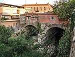
The "Red Basilica" (Turkish: Kızıl Avlu), also called variously the Red Hall and Red Courtyard, is a monumental ruined temple in the ancient city of Pergamon, now Bergama, in western Turkey. The temple was built during the Roman Empire, probably in the time of Hadrian and possibly on his orders. It is one of the largest Roman structures still surviving in the ancient Greek world. The temple is thought to have been used for the worship of Egyptian gods – specifically Isis and/or Serapis, and possibly also Osiris, Harpocrates and other lesser gods, who may have been worshipped in a pair of drum-shaped rotundas, both of which are virtually intact, alongside the main temple. Although the building itself is of an immense size, it was only one part of a much larger sacred complex, surrounded by high walls, that dwarfed even the colossal Temple of Jupiter in Baalbek. The entire complex was built directly over the River Selinus in a remarkable feat of engineering that involved the construction of an immense bridge 196 metres (643 ft) wide to channel the river through two channels under the temple. The Pergamon Bridge still stands today, supporting modern buildings and even vehicle traffic. A series of tunnels and chambers lies under the main temple, connecting it with the side rotundas and giving private access to different areas of the complex. Various drains, water channels and basins are located in, around and under the main temple and may have been used for symbolic reenactments of the flooding of the Nile. The temple was converted by the Romans into a Christian church dedicated to St John but was subsequently destroyed. Today the ruins of the main temple and one of the side rotundas can be visited, while the other side rotunda is still in use as a small mosque.