Juyubit
Former Native American populated places in CaliforniaFormer populated places in CaliforniaFormer settlements in Los Angeles County, CaliforniaLos Angeles County, California geography stubsNative American populated places ... and 3 more
San Gabriel ValleySerrano populated placesTongva populated places
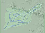
Juyubit (also, Jujubit) was one of the largest villages of the Tongva people. The village was located at the foot of the West Coyote Hills at the confluence of the Coyote and La Cañada Verde creeks, in present-day Buena Park and Cerritos. It was one of the largest villages in Tovaangar. Alternate names of the village include: Jujubit, Jutucubit, Jutucuvit, Jutubit, Jutucunga, Utucubit, Otocubit, Uchubit, Ychubit, and Uchunga.
Excerpt from the Wikipedia article Juyubit (License: CC BY-SA 3.0, Authors).Juyubit
Coyote Creek Bikeway,
Geographical coordinates (GPS) Address Nearby Places Show on map
Geographical coordinates (GPS)
| Latitude | Longitude |
|---|---|
| N 33.868055555556 ° | E -118.03333333333 ° |
Address
Coyote Creek Bikeway
Coyote Creek Bikeway
90623
California, United States
Open on Google Maps


