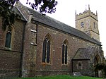
Horsington, Somerset
Civil parishes in SomersetVillages in South Somerset

Horsington is a village and Civil parish in Somerset, England, situated 4 miles (6.4 km) south of Wincanton and 1 mile (1.6 km) north of Templecombe in the South Somerset district. The village lies on the edge of Horsington Marsh, part of the Blackmore Vale. In 2011 the population of the Parish, which includes the adjoining hamlets of Peckholdsash and Wilkin Throop and the village of South Cheriton was 571.
Excerpt from the Wikipedia article Horsington, Somerset (License: CC BY-SA 3.0, Authors, Images).Horsington, Somerset
Duck Lane,
Geographical coordinates (GPS) Address Nearby Places Show on map
Geographical coordinates (GPS)
| Latitude | Longitude |
|---|---|
| N 51.012937 ° | E -2.425881 ° |
Address
Duck Lane
Duck Lane
BA8 0EG
England, United Kingdom
Open on Google Maps


