Anglezarke

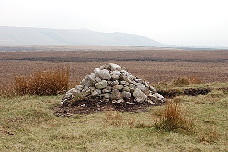
Anglezarke is a sparsely populated civil parish in the Borough of Chorley in Lancashire, England. It is an agricultural area used for sheep farming, also site of reservoirs that were built to supply water to Liverpool. The area has a large expanse of moorland with many public footpaths and bridleways. The area is popular with walkers and tourists, it lies in the West Pennine Moors in Lancashire, sandwiched between the moors of Withnell and Rivington, and is close to the towns of Chorley, Horwich and Darwen. At the 2001 census it had a population of 23. At the 2011 Census the population is included within Heapey civil parish. The area was subjected to depopulation after the reservoirs were built.
Excerpt from the Wikipedia article Anglezarke (License: CC BY-SA 3.0, Authors, Images).Anglezarke
Moor Road,
Geographical coordinates (GPS) Address Nearby Places Show on map
Geographical coordinates (GPS)
| Latitude | Longitude |
|---|---|
| N 53.649 ° | E -2.574 ° |
Address
Moor Road
Moor Road
PR6 9DQ , Anglezarke
England, United Kingdom
Open on Google Maps


