place

Naumkeag

1880s architecture in the United States1958 establishments in MassachusettsChoate familyGardens in MassachusettsGilded Age
Gilded Age mansionsHistoric districts on the National Register of Historic Places in MassachusettsHistoric house museums in MassachusettsHouses completed in 1887Houses on the National Register of Historic Places in Berkshire County, MassachusettsLandscape design history of the United StatesMcKim, Mead & White buildingsMuseums in Stockbridge, MassachusettsNRHP infobox with nocatNational Historic Landmarks in MassachusettsProtected areas established in 1958Shingle Style architecture in MassachusettsShingle Style housesStockbridge, MassachusettsThe Trustees of ReservationsUse mdy dates from August 2023
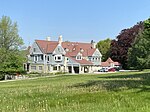
Naumkeag (Stockbridge, MA) general view

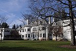
Naumkeag is the former country estate of noted New York City lawyer Joseph Hodges Choate and Caroline Dutcher Sterling Choate, located at 5 Prospect Hill Road, Stockbridge, Massachusetts. The estate's centerpiece is a 44-room, Shingle Style country house designed principally by Stanford White of McKim, Mead & White, and constructed in 1885 and 1886. The estate is noted for its large gardens, which were designed in the mid-20th century by noted landscape designer Fletcher Steele in conjunction with Mabel Choate. A National Historic Landmark District, Naumkeag is now owned by The Trustees of Reservations, who operate it as a nonprofit museum.

Excerpt from the Wikipedia article Naumkeag (License: CC BY-SA 3.0, Authors, Images).

Geographical coordinates (GPS)

Latitude Longitude
N 42.289694444444 ° E -73.315861111111 °
placeShow on map

Address

Naumkeag Garden

Sergeant Street
01263
Massachusetts, United States
mapOpen on Google Maps

Website
naumkeag.thetrustees.org

linkVisit website

linkWikiData (Q6981257)
linkOpenStreetMap (29784994)

Naumkeag (Stockbridge, MA) general view
Share experience

Nearby Places

National Shrine of The Divine Mercy (Stockbridge, Massachusetts)

The National Shrine of The Divine Mercy is a Catholic shrine located in Stockbridge, Massachusetts. The priests and brothers of the Congregation of Marian Fathers of the Conception of the Most Blessed Virgin Mary have resided on Eden Hill in Stockbridge, since June 1944. Father Walter Pelczynski, MIC, with the assistance of local clergy and friends of the Marian community, initially purchased 50 of the 370 acres (1.5 km2) that constituted the "Eden Hill" estate in November, 1943. The house was to serve as the novitiate for a newly formed province. An image of "The Divine Mercy" was enshrined in one of the small chapels where the members of the community prayed daily a perpetual novena to the Divine Mercy. Pilgrims began to arrive the very next spring to celebrate the Feast of The Divine Mercy (the Sunday after Easter). By the end of World War II in 1945, pilgrims in growing numbers came to offer thanksgiving for graces received through the Divine Mercy message and devotion. They urged the Marians to build a shrine to Jesus, The Divine Mercy, as a votive of thanks. The Fathers decided to accede to the requests since there was also a need for a larger chapel to accommodate a growing community. The construction of the present Shrine began in 1950 and was completed and solemnly dedicated by Springfield Bishop Christopher Weldon in 1960. In 1996, the United States Conference of Catholic Bishops declared it a National Shrine in accord with Church law. The National Shrine has drawn thousands of pilgrims from around the world.

Main Street Historic District (Stockbridge, Massachusetts)

The Main Street Historic District is a historic district encompassing the scenic and historic portions of Main Street in Stockbridge, Massachusetts. The downtown portion of Main Street is widely recognizable due to its use by Norman Rockwell in his 1967 painting, Main Street, Stockbridge at Christmas. The central portion of Main Street is a broad street with wide green lawns, anchored by a traditional New England town center containing a church and municipal buildings. Along this part of Main Street is the Mission House, a National Historic Landmark that is one of oldest buildings in Stockbridge, dating to the early 1740s. Further to the west the road is more rural, and the district's western boundary is at the crossing of Main Street over the Housatonic River. The eastern part of the district includes the retail heart of the town, including the Red Lion Inn and several blocks of shops. The far eastern part of the district is Laurel Hill, a wooded park with views of the town center. The district was added to the National Register of Historic Places in 2002.The Stockbridge area has a significant prehistory of Native American use, with archaeological evidence of human use on at least a seasonal basis dating back for centuries. In the early 18th century it was settled by Mahican Indians who had been driven from the Hudson River area by conflict with the Mohawks. These uses included the establishment of a Native burying ground, which is within the bounds of this district. In 1734, the Province of Massachusetts Bay founded a "Praying Indian" community, with its main settlement where the downtown area is now. The arrival of English squatters and conflicts over land usage patterns led to the Natives eventually losing control of the community. The area's colonial settlement accelerated after the end of the French and Indian War in 1763. The Red Lion Inn opened in 1775, and it flourished in the early 19th century as a crossroads community not far from the county seat at Lenox.

Elm–Maple–South Streets Historic District

The Elm–Maple–South Streets Historic District is a historic district encompassing part of the historic downtown of Stockbridge, Massachusetts. The most prominent parts of Stockbridge lie within the Main Street Historic District, which abuts this district to the north. The southern boundary of this district is the railroad tracks that run parallel to the Housatonic River. The eastern boundary of the district is Laurel Hill, a wooded park overlooking the town, and the western boundary is a terraced shelf in the plains of the river. The district includes properties on Depot, Elm, Maple, and South Streets, and Laurel Lane. Unlike Main Street, this district consists of more densely place residences, and narrower roads containing businesses just off Main Street. Its buildings were mostly constructed during the late 19th and early 20th centuries, and partially reflect Elm Street's function as an industrial part of the town. The district was added to the National Register of Historic Places in 2004.Stockbridge was founded in the 1730s as a "Praying Indian" community, with its main settlement where the downtown area is now. South Street began as a Native American trail leading to the south, crossing the river at a fordable location. A bridge was first built near where the modern bridge now stands in 1744. The junction of Main and South Streets became a major local commercial nexus by later in the 18th century, with the area closer to the river where small industries began to flourish. One of Berkshire County's first printing operations was begun in this area, and there was by the mid-19th century a blacksmithy. A few houses stood in the area by the turn of the 19th century, but it was not until the 1850s that a significant number of houses began to be built south of Main Street. Many of these were populated by people engaged in trades for travelers, or otherwise engaged in business on Main Street. One of the older houses and the largest in the district, the Tidmarsh-Edwards House at 8 South Street, has had a number of notable residents, including politician and businessman John Z. Goodrich.