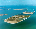
Lake Erie Metropark

Lake Erie Metropark is a park in the Huron-Clinton system of metro parks. The park is a 1,607-acre (6.50 km2) recreational facility located between the mouth of the Huron River on Lake Erie to the south and the City of Gibraltar to the north, and consists of natural marshes and ponds, hike and bike trails, nature trails, a marina, and a boat launch. The park also has a wave action swimming pool, an 18-hole regulation golf course, and the Marshlands Museum and Nature Center. It has a three-mile (5 km) shoreline along Lake Erie and is a popular bird-watching site. The children's play area, located near the Wave Pool, previously consisted of a child-size city before being reconstructed into a modernized playground.
Excerpt from the Wikipedia article Lake Erie Metropark (License: CC BY-SA 3.0, Authors, Images).Lake Erie Metropark
Main Park Road,
Geographical coordinates (GPS) Address Nearby Places Show on map
Geographical coordinates (GPS)
| Latitude | Longitude |
|---|---|
| N 42.070616666667 ° | E -83.210811111111 ° |
Address
Main Park Road
Main Park Road
48173
Michigan, United States
Open on Google Maps


