Neukölln (locality)
Localities of BerlinNeukölln

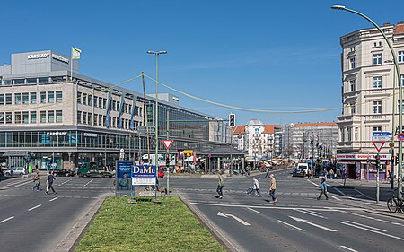
Neukölln (German: [nɔʏˈkœln] (listen); formerly Rixdorf), until 1920 an independent city, is an inner-city district of Berlin in the homonymous borough (Bezirk) of Neukölln, including the historic village of Alt-Rixdorf and numerous Gründerzeit apartment blocks. With 166,714 inhabitants (2018) the Ortsteil is the most densely populated of Berlin. It was originally characterized by mostly working-class inhabitants and later a relatively high percentage of immigrants, especially of Turkish and Russian descent, but since the turn of the millennium an influx of students, creatives, and western immigrants has led to gentrification.
Excerpt from the Wikipedia article Neukölln (locality) (License: CC BY-SA 3.0, Authors, Images).Neukölln (locality)
Erkstraße, Berlin Neukölln
Geographical coordinates (GPS) Address Nearby Places Show on map
Geographical coordinates (GPS)
| Latitude | Longitude |
|---|---|
| N 52.481388888889 ° | E 13.435277777778 ° |
Address
Rathaus Neukölln
Erkstraße
12043 Berlin, Neukölln
Germany
Open on Google Maps


