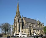
Ramsbottom Urban District
Districts of England abolished by the Local Government Act 1972Districts of England created by the Local Government Act 1894Greater Manchester geography stubsHistory of LancashireHistory of the Metropolitan Borough of Bury ... and 4 more
Lancashire geography stubsLocal government in the Metropolitan Borough of BuryRamsbottomUrban districts of England
Ramsbottom Urban District was, from 1894 to 1974, a local government district of the administrative county of Lancashire, England. Its area was coterminate with Ramsbottom, spanning an area of the Rossendale Valley north of the County Borough of Bury. The Urban District was created by the Local Government Act 1894, and abolished by the Local Government Act 1972; in 1974 the Central, East, South and West wards of the district joined the Metropolitan Borough of Bury, the North and Walmersley cum Shuttleworth wards to the Borough of Rossendale.
Excerpt from the Wikipedia article Ramsbottom Urban District (License: CC BY-SA 3.0, Authors).Ramsbottom Urban District
Gordon Street,
Geographical coordinates (GPS) Address Nearby Places Show on map
Geographical coordinates (GPS)
| Latitude | Longitude |
|---|---|
| N 53.6 ° | E -2.3 ° |
Address
Gordon Street
Gordon Street
BL9 0JU , Fernhill
England, United Kingdom
Open on Google Maps


