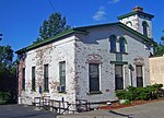
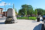
The South End–Groesbeckville Historic District is located in part of the neighborhood of that name in Albany, New York, United States. It is a 26-block, 57-acre (23 ha) area south of the Mansion and Pastures neighborhoods with a mix of residential and commercial properties. In 1984 it was recognized as a historic district and listed on the National Register of Historic Places.
For several decades after the city's founding in the late 17th century, the South End was undeveloped. In 1761 General Philip Schuyler built his house there. Today it is a National Historic Landmark, the oldest building in the district and the only contributing property in the district individually listed on the National Register.
As the city grew following the opening of the Erie Canal in the early 19th century, development did not reach the South End immediately, save for an early toll road, now South Pearl Street (part of New York State Route 32) built in the first years of the 19th century, which later became the backbone of the South End. Planned streets for the neighborhood were included in Albany's grid pattern as early as 1818. They were built in the middle of the century, and by the 1870s the district had begun growing rapidly, fueled by German immigrants, a group still closely associated with the South End and the first of several waves of immigrants to leave their mark on it. Irish Americans would also consider it theirs even as they dispersed to other parts of the city, and one native of the district, Daniel P. O'Connell, grew up to become boss of the city's Democratic political machine well into the 20th century, using a now-demolished building in the district as his headquarters.The district is the only large area of Albany predating the 20th century where houses were largely built by the future occupants one at a time, rather than in large sets of speculative houses by developers (as one later historian put it "[it] wasn't planned, it just grew"), resulting in great architectural variety. The hamlet of Groesbeckville in the neighboring Town of Bethlehem, which at the time was just to the south, grew along similar lines and was soon absorbed into the city, the first expansion of Albany's southern boundary. The new neighborhood became the first home for many of the immigrant groups that would populate the city into the 20th century, including African Americans dislocated by urban renewal elsewhere in the city. Today the district remains largely intact (only 13 of the district's 520 buildings, or 2.5 percent, were, at the time of listing, non-contributing) but struggles with the effects of urban decay. A neighborhood association has worked with the city to develop a revitalization plan.


