Place des États-Unis

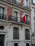
The Place des États-Unis (French: [plas dez‿e.taz‿y.ni]; "United States Square") is a public space in the 16th arrondissement of Paris, France, about 500 m south of the Place de l'Étoile and the Arc de Triomphe. It consists of a plaza, approximately 140 m (460 ft) long and 30 m (98 ft) wide, tree-lined, well-landscaped, and circumscribed by streets, forming a pleasant and shady vest-pocket park. The park is officially named Square Thomas Jefferson, but buildings facing it (on three sides) have Place-des-États-Unis addresses. The eastern end of the square, however, is capped by the Avenue d'Iéna and a confluence of streets known as the Place de l'Amiral de Grasse. These streets, all of which lead to the eastern end of Place des États-Unis, are the Rue Freycinet, Rue de Lübeck, Rue de Bassano, and the Rue Georges Bizet. Other streets entering the Place des États-Unis include: the Rue de l'Amiral d'Estaing, which enters from the south; the Rue Galilée, which transits the western end of Square Thomas Jefferson; and the Rue Dumont d'Urville which enters the northwestern corner.
Excerpt from the Wikipedia article Place des États-Unis (License: CC BY-SA 3.0, Authors, Images).Place des États-Unis
Paris 16th Arrondissement (Paris)
Geographical coordinates (GPS) Address Nearby Places Show on map
Geographical coordinates (GPS)
| Latitude | Longitude |
|---|---|
| N 48.868007 ° | E 2.294083 ° |
Address
75116 Paris, 16th Arrondissement (Paris)
Ile-de-France, France
Open on Google Maps


