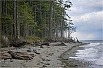
Red Gap, British Columbia
Company towns in CanadaGhost towns in British ColumbiaMid Vancouver IslandPopulated places in the Regional District of NanaimoUse Canadian English from January 2023
Red Gap is southeast of Nanoose Bay on the east coast of southern Vancouver Island, British Columbia. The ghost town on BC Highway 19 is by road about 22 kilometres (14 mi) north of Nanaimo, and 16 kilometres (10 mi) south of Parksville.
Excerpt from the Wikipedia article Red Gap, British Columbia (License: CC BY-SA 3.0, Authors).Red Gap, British Columbia
East Island Highway, Area E (Nanoose Bay)
Geographical coordinates (GPS) Address Nearby Places Show on map
Geographical coordinates (GPS)
| Latitude | Longitude |
|---|---|
| N 49.253055555556 ° | E -124.17111111111 ° |
Address
Nanoose Rest Area
East Island Highway
V9P 9E2 Area E (Nanoose Bay)
British Columbia, Canada
Open on Google Maps


