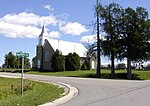
Tay Canal
Canals in OntarioCanals opened in 1834Canals opened in 1887National Historic Sites in OntarioShip canals ... and 1 more
Use Canadian English from January 2023

The Tay Canal is the portion of the Tay River in the eastern Ontario region, providing a connection between the town of Perth and the Rideau Canal at Beveridge Bay on Lower Rideau Lake. The canal is 9.8 km (6.1 mi) in length and is operated today by Parks Canada as part of their Rideau Canal operations. At the entrance to the Tay Canal are two locks, Upper and Lower Beveridge Locks, which provide a total lift of 7.6 m (25 ft).
Excerpt from the Wikipedia article Tay Canal (License: CC BY-SA 3.0, Authors, Images).Tay Canal
Port Elmsley Road, Drummond-North Elmsley
Geographical coordinates (GPS) Address Nearby Places Show on map
Geographical coordinates (GPS)
| Latitude | Longitude |
|---|---|
| N 44.878 ° | E -76.149 ° |
Address
Tent Cabins
Port Elmsley Road
K0G 1W0 Drummond-North Elmsley
Ontario, Canada
Open on Google Maps


