Czerwony Dwór, Węgorzewo County
Villages in Węgorzewo CountyWęgorzewo County geography stubs
Czerwony Dwór [t͡ʂɛrˈvɔnɨ ˈdvur] (German: Rothof, Lithuanian: Raudondvaris) is a village in the administrative district of Gmina Węgorzewo, within Węgorzewo County, Warmian-Masurian Voivodeship, in northern Poland, close to the border with the Kaliningrad Oblast of Russia. It lies approximately 2 kilometres (1 mi) north-east of Węgorzewo and 97 km (60 mi) north-east of the regional capital Olsztyn. The village has a population of 170.
Excerpt from the Wikipedia article Czerwony Dwór, Węgorzewo County (License: CC BY-SA 3.0, Authors).Czerwony Dwór, Węgorzewo County
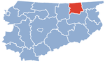
gmina Węgorzewo
Geographical coordinates (GPS) Address Nearby Places Show on map
 Continue reading on Wikipedia
 Geographical coordinates (GPS)
| Latitude | Longitude |
|---|---|
| N 54.229722222222 ° | E 21.763333333333 ° |
Address
8a
11-600 gmina Węgorzewo
Warmian-Masurian Voivodeship, Poland
Open on Google Maps