place

London Road viaduct

Grade II* listed buildings in Brighton and HoveGrade II* listed railway bridges and viaductsRailway viaducts in East SussexUse British English from March 2017
London road viaduct2

The London Road Viaduct is a brick railway viaduct in Brighton, part of the city of Brighton and Hove in East Sussex, England. It carries the East Coastway Line between Brighton and London Road railway stations. Built in the 1840s for the Brighton, Lewes and Hastings Railway by the locomotive engineer and railway architect John Urpeth Rastrick, the sharply curving structure has 27 arches and about 10 million bricks. It is still in constant use, and is listed at Grade II* for its historical and architectural significance.

Excerpt from the Wikipedia article London Road viaduct (License: CC BY-SA 3.0, Authors, Images).

London Road viaduct
Preston Road, Brighton Prestonville

Geographical coordinates (GPS) Address Nearby Places
placeShow on map

Wikipedia: London Road viaductContinue reading on Wikipedia

Geographical coordinates (GPS)

Latitude Longitude
N 50.8353 ° E -0.1421 °
placeShow on map

Address

CRS Car Detailing

Preston Road
BN1 4QG Brighton, Prestonville
England, United Kingdom
mapOpen on Google Maps

London road viaduct2
Share experience

Nearby Places

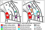
New England Quarter
New England Quarter

The New England Quarter is a mixed-use development in the city of Brighton and Hove, England. It was built between 2004 and 2008 on the largest brownfield site in the city, adjacent to Brighton railway station. Most parts of the scheme have been finished, but other sections are still being built and one major aspect of the original plan was refused planning permission.The site, a steeply sloping hillside between a main railway line and one of Brighton's main roads, had been the home of a railway locomotive works and goods yard for more than a century. High-density housing was built at the same time and surrounded the railway buildings. From the 1960s, the area fell into decline: the works and goods yard were closed and demolished, and most of the housing was cleared. This left large areas of derelict land which attracted small-scale redevelopment and transient commercial enterprises. Proposals for redevelopment were made from the 1980s onwards; in 2001 a master plan was granted planning permission by Brighton and Hove City Council. Site clearance work followed, and construction began in 2004. The New England Quarter consists of separately planned areas (called "Blocks" in the master plan) connected by new or altered road infrastructure and pedestrian links. Land use includes private and council housing of various styles and configurations, office and retail space, a college, a hotel, public space and community facilities. Some of the residential development aims to meet high environmental and sustainability standards, and green space is being provided on former railway land. The scheme has attracted criticism from various sources, and certain aspects and proposals have been particularly controversial. A planned 42-storey hotel and residential building on one block—which was not in the original plan and for which planning permission was later denied—was opposed by many local people and politicians, and was eventually rejected by a government minister on appeal. The decision to allow a large supermarket branch to be built in the middle of the development was also unpopular. A campaign group was formed to co-ordinate and raise the awareness of people's concerns.