place

Lamb (island)

Islands of the ForthLandforms of East LothianLothians geography stubsMicronations in ScotlandNorth Berwick
Uninhabited islands of Scotland
The lamb island
The lamb island

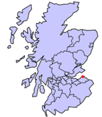
Lamb, sometimes called Lamb Island or The Lamb, is a small uninhabited island measuring approximately 100 by 50 metres (330 ft × 160 ft), between the islands of Fidra and Craigleith in the Firth of Forth, off the east coast of Scotland. The Lamb is flanked by two "sheep dogs", North and South Dog Islands, which are basically small skerries. Like the other Islands of the Forth off North Berwick, the Lamb is a result of volcanic activity millions of years ago.

Excerpt from the Wikipedia article Lamb (island) (License: CC BY-SA 3.0, Authors, Images).

Geographical coordinates (GPS)

Latitude Longitude
N 56.069 ° E -2.748 °
placeShow on map
The lamb island
The lamb island
Share experience

Nearby Places

Yellowcraig
Yellowcraig

Yellowcraig, also known as Broad Sands Beach, is a coastal area of forest, beach and grassland in East Lothian, south-east Scotland. Yellowcraig is partly within the Firth of Forth Site of Special Scientific Interest (SSSI). It is bordered to the north by the Firth of Forth, to the south by the village of Dirleton and Dirleton Castle, to the east by the North Berwick West Links golf course, and to the west by the Archerfield Estate and Links golf courses. Access to Yellowcraig is by the A198 coastal route through Dirleton. A visitor car park lies 270 metres (300 yd) south of the beach. The area includes information displays, a barbecue area and a Treasure Island themed adventure play park. WCs and showers are located at the car park. There is also a wheelchair accessible path and ramp giving a view over the beach.Yellowcraig is on the John Muir Way, a 73-kilometre (45 mi) long distance footpath between Fisherrow, Musselburgh and Dunglass, named in honour of the conservationist John Muir, who was born in Dunbar. Yellowcraig is featured in the leaflet Aberlady to North Berwick among a series of leaflets on the John Muir Way. The John Muir Way is part of the North Sea Trail, a network of paths in 7 countries and 26 areas around the North Sea.The island of Fidra, reputedly the inspiration for Robert Louis Stevenson's Treasure Island, lies just to the north-west and is an RSPB nature reserve.The East Lothian Countryside Ranger Service co-ordinates the day-to-day management of this site.

North Berwick Lifeboat Station

North Berwick Lifeboat Station is a Royal National Lifeboat Institution (RNLI) marine-rescue facility in North Berwick, East Lothian, Scotland. The RNLI first allotted a lifeboat to North Berwick in 1869, in response to the nearby shipwreck of the schooner Bubona the year before. The station closed in 1925 but was re-established in 1967, when the viewers of the BBC children's television programme Blue Peter funded the purchase of four D class lifeboats—one of which, the Blue Peter III, was assigned to North Berwick. Between the years of 1967 and 2013 five Blue Peter Lifeboats, all named Blue Peter III, were placed on station and collectively rescued over 277 people.The current lifeboat on station is a D-class (D758), the Evelyn M, named after Evelyn Murdoch whose charitable trust (the Evelyn M Murdoch Charitable Trust) paid for the construction of the vessel. The lifeboat was handed over to the RNLI at a ceremony in September 2013 and was accepted on behalf of the RNLI and passed into the care of volunteer crew at North Berwick Lifeboat Station by Sir Peter Housden, Permanent Secretary of the Scottish Government and an RNLI council member. The service of dedication was led by Reverend Neil Dougall, and the boat was named Evelyn M by Helen Hanson, trustee of the Miss Evelyn M Murdoch Charitable Trust.In the last 100 years the station's rescue crews have received three RNLI awards for gallantry and three Blue Peter gold badges.