place

Saints Peter and Paul Melkite Catholic Church

1980 establishments in Ontario20th-century churches in CanadaCanadian church stubsChurches completed in 1980Churches in Ottawa
Commons link is the pagenameEastern Catholic church stubsLebanese-Canadian cultureMelkite Greek Catholic churches in Canada
St Peter and Paul Melkite church Ottawa

Saints Peter and Paul Melkite Catholic Church is a Melkite Greek Catholic Church in Ottawa, Ontario, Canada. It is located on 1161 North River Road in Overbrook, just to the east of the Rideau River.

Excerpt from the Wikipedia article Saints Peter and Paul Melkite Catholic Church (License: CC BY-SA 3.0, Authors, Images).

Saints Peter and Paul Melkite Catholic Church
North River Road, Ottawa

Geographical coordinates (GPS) Address External links Nearby Places
placeShow on map

Wikipedia: Saints Peter and Paul Melkite Catholic ChurchContinue reading on Wikipedia

Geographical coordinates (GPS)

Latitude Longitude
N 45.421047 ° E -75.661812 °
placeShow on map

Address

Sts. Peter and Paul Melkite Catholic Church

North River Road 1161
K1N 8P4 Ottawa (Rideau-Rockcliffe)
Ontario, Canada
mapOpen on Google Maps

linkWikiData (Q7402428)
linkOpenStreetMap (68710405)

St Peter and Paul Melkite church Ottawa
Share experience

Nearby Places

Royal Canadian Mounted Police

The Royal Canadian Mounted Police (RCMP; French: Gendarmerie royale du Canada; GRC) is the national police service of Canada. The RCMP is an agency of the Government of Canada; it also delivers police services under contract to 11 provinces and territories, over 150 municipalities, and 600 Indigenous communities. The RCMP is commonly known as the Mounties in English (and colloquially in French as la police montée). The Royal Canadian Mounted Police was established in 1920 with the amalgamation of the Royal North-West Mounted Police and the Dominion Police. Sworn members of the RCMP have jurisdiction as a peace officer in all provinces and territories of Canada. Under its federal mandate, the RCMP is responsible for enforcing federal legislation; investigating inter-provincial and international crime; border integrity; overseeing Canadian peacekeeping missions involving police; managing the Canadian Firearms Program, which licenses and registers firearms and their owners; and the Canadian Police College, which provides police training to Canadian and international police services. Policing in Canada is considered to be a constitutional responsibility of provinces, however, the RCMP provides local police services under contract in all provinces and territories except Ontario and Quebec. Despite its name, the Royal Canadian Mounted Police are no longer an actual mounted police service, and horses are only used at ceremonial events and certain other occasions. The Government of Canada considers the RCMP to be an unofficial national symbol, and in 2013, 87 per cent of Canadians interviewed by Statistics Canada said that the RCMP was important to their national identity. However, the service has faced criticism for its broad mandate, and its public perception in Canada has gradually soured since the 1990s, worn down by workplace culture lawsuits, several high-profile scandals, staffing shortages, and the service's handling of incidents like the 2020 Nova Scotia attacks.

Overbrook, Ottawa

Overbrook is an urban neighbourhood situated in Rideau-Rockcliffe Ward, in the east end of Ottawa, Ontario, Canada. It is located across the Rideau River from the neighbourhood of Sandy Hill and is just to the south of Vanier. To the east of Overbrook is the former City of Gloucester. It was constituted as a police village in 1922 and was annexed by the City of Ottawa in 1950.Overbrook covers an area of 3.04 square kilometres and has a population density of 3,174 people per square kilometre (2011 Census). Overbrook's main street is Queen Mary Street, which runs from North River Road to St. Laurent Boulevard. Although predominantly a residential neighbourhood at Overbrook's south end is Coventry Road where commercial and office buildings are found along with a major shopping centre (St. Laurent Centre) at the intersection with St. Laurent Boulevard. The neighborhood of Overbrook is bounded on the north by the former City of Vanier, on the west by the Rideau River, on the south by provincial Highway 417 (the Queensway) and on the east by St. Laurent Boulevard. The eastern part of the community overlaps with the Castle Heights neighbourhood. The neighbourhood was in the fifth of 5 socio-economic levels, with 1 representing the most advantaged neighbourhood and 5 the least advantaged neighbourhood. A minority (36%) of the residents owned their homes, while 64% rented. Housing is unaffordable for many residents in West Overbrook; 32% spend more than 30% of their income on shelter. Eight percent of the dwellings were reported to be in need of major repairs (higher than city average). The number of persons per room (0.46), a measure of crowding, was also higher than the city average. In 2005, the property crime rate of 66.4 per thousand people was higher than the city average of 57 per thousand people. Personal crime rates were also higher than the city average of 24 per thousand people, at 52.8 per thousand people. 2016 Census of Canada data indicate that knowledge of official languages has 47% of the population speaking English only and 47% speaking both English and French and the remaining 6% French only or neither English or French. Overbrook is relatively close to downtown Ottawa and is seeing increased residential infill redevelopment. This is being aided by recent transportation connectivity improvements such as the 2015 opening of the Adàwe Crossing (pedestrian and cyclist bridge across the Rideau River) and the ability to use the Max Keeping Bridge (pedestrian and cyclist bridge over Highway 417) to access both Via Rail Ottawa station and the newer Tremblay station, which opened in 2019 on the O-Train Confederation Line.

Adàwe Crossing
Adàwe Crossing

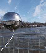
The Adàwe Crossing (French: passerelle Adàwe) is a pedestrian and cyclist bridge in Ottawa, Ontario, Canada, built across the Rideau River. It is located about 1,200 metres (1,300 yd) north (downstream) of the Highway 417 bridge (Provincial Constable J. Robert Maki Bridge) and 800 metres (870 yd) south (upstream) from the Cummings Bridge. It was opened on December 4, 2015 and links the communities of Overbook and Sandy Hill. The Adàwe Crossing is an approximately 125m long bridge structure that consists of three spans with variable steel girders and a composite concrete deck. The usable deck width is 4m and it increases to a 7m width at the two mid-river piers which provide for two lookout areas on both the north and south sides. The Rideau River is a navigable river and the height of the bridge respects water clearance requirements including those for the annual spring ice clearing operations.The design and construction budget for the bridge and related works was $9.2 million. This included construction of multi-use pathway connections from the bridge west through Strathcona Park to the Range Road and Somerset Street East intersection and east along Donald Street to North River Road, together with rehabilitation of the parking lot in Strathcona Park and a short section of Donald Street. In the first ten days after the bridge opened about 20,000 trips were taken across it by pedestrians and cyclists. The busiest user month to date was July 2017 with over 121,000 trip crossings. During the prime cycling months of May to September inclusive the monthly crossing totals range between 90,000 and 110,000 trips, generally evenly split between pedestrians and cyclists. The Adàwe Crossing continues to prove to be a popular location to take photos from the bridge, of the bridge and of the bridge's art work "A View from Two Sides".The Adàwe Crossing and its pathways are part of a City of Ottawa crosstown bikeway (Route #3) identified in the Ottawa Cycling Plan. To the west this crosstown bikeway leads via Somerset Street East to the nearby University of Ottawa and downtown of Ottawa. The bikeway route continues to the Corktown Footbridge over the Rideau Canal.

Strathcona Park (Ottawa)

Strathcona Park is a large park in Ottawa, Ontario, Canada. It lies on the west bank of the Rideau River and marks the eastern edge of the Sandy Hill neighbourhood. The area of the park was originally the swampy floodplain of the river and impossible to build on. The site first became home of the Dominion Rifle Range, where soldiers had trained before departing for the Second Boer War. That history is preserved in the name of Range Road, which runs along the west of the park. The area was turned into a park by the Ottawa Improvement Commission between 1904 and 1907. It was named after Lord Strathcona, a Canadian businessman and politician who had financed his own regiment in the war.The most prominent feature of the 15-acre (6.1 ha) park is the fountain atop the hill; it was donated by Lord Strathcona in 1909 and sculpted by French artist, Mathurin Moreau. The four upright figures symbolize the four continents (Europe, Asia, Africa, America), which was a commonly used artistic metaphor until the 19th Century. A twin fountain stands in downtown Buenos Aires. The park's original design was a classic example of English public park design. It contained a pair of small ponds, gazebos, and Ottawa's first golf course. In the 1940s, the ponds were filled in because of their expense and replaced with a wading pool. A baseball diamond was constructed at the southern end of the park in the 1920s and, for many years, was Ottawa's main venue for the sport. The banks of the Rideau were once a popular swimming area, but the perception of pollution now make that unpopular. During the summer, the water level is low enough to ford the river and cross to Riverain Park in Vanier, but the Adàwe Crossing bridge, opened in December 2015, now makes fording the river unnecessary. Just to the south of Strathcona Park is Dutchy's Hole Park and Robinson Field. In the winter, the park, with its large hill at the northern end, is a popular site for tobogganing and making snowboard jumps. The park remained under the control of the OIC successor agency the National Capital Commission until 1987, when it did not renew its lease with the city. Since then, the park has been managed by the municipality. In the early 1990s, the park was refurbished by the city. One of the most noted additions was the play structure designed by artist Stephen Brathwaite, who designed a structure to look like ruins and was inspired by Mackenzie King's ruin garden at Kingsmere. The structure was assembled out of blocks of stone that had been part of the Parliament buildings, the Chateau Laurier, and other prominent Ottawa structures. Since 1986, the park has been home to Odyssey Theatre, a professional company that presents open-air plays each summer on a stage at the northeast corner of the park. Odyssey Theatre's unique performances of classical plays and original creations are inspired by the Italian commedia dell'arte and incorporate international forms of puppetry, clowning, and dance-theatre. In July 2014, the city began construction of a pedestrian and cyclist bridge across the Rideau River to connect the Rideau River Eastern Pathway at Donald Street with Strathcona Park and Somerset Street East.The park is surrounded by a series of large homes that once housed the elite of Ottawa. Most are now embassies, and the area around the park is often called Ottawa's Embassy Row. Perched above the park is the Russian embassy, formerly the Soviet Union embassy.