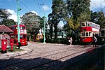
Carlton Colville

Carlton Colville is a seaside town and civil parish in the English county of Suffolk. It is 3 miles (5 km) south-west of the centre of the town of Lowestoft in the East Suffolk district. The area lies along the A146 Lowestoft to Beccles road. Carlton Colville has boundaries with Oulton Broad, Gisleham and Pakefield. It forms the south-western edge of Lowestoft, with Mutford 2 miles (3 km) to the south-east. The electoral ward continues to the north to the River Waveney and had a population of 6,612 at the 2001 census, increasing to 8,505 at the 2011 census. A civil parish, the parish council adopted town council status in August 2011, retaining the same powers and funding.
Excerpt from the Wikipedia article Carlton Colville (License: CC BY-SA 3.0, Authors, Images).Carlton Colville
Sunbeam Close, East Suffolk
Geographical coordinates (GPS) Address Nearby Places Show on map
Geographical coordinates (GPS)
| Latitude | Longitude |
|---|---|
| N 52.454 ° | E 1.691 ° |
Address
Sunbeam Close
Sunbeam Close
NR33 8GA East Suffolk
England, United Kingdom
Open on Google Maps


