place

Wolfe Island Wind Farm

Buildings and structures in Frontenac CountyWind farms in Ontario
Wolfe island wind farm ls 09

Wolfe Island Wind Farm is a large wind farm project located on Wolfe Island, Ontario (near Kingston, Ontario). The wind farm became operational on June 29, 2009. It is owned and operated by Canadian Hydro Developers, Inc., through its subsidiary Canadian Renewable Energy Corporation (CREC). The power will be purchased by Hydro One for distribution to consumers. The wind farm consists of eighty-six 2.3-megawatt (MW) Siemens model Mark II wind turbines situated on the western portion of Wolfe Island.Once completed, the 197.8 MW project was expected to generate approximately 594 gigawatt-hours (GW·h) of renewable power annually; enough to supply about 75,000 average households. Over its first four full years of operation, generation proved to be around 495 GWh annually (see below). Winds of 3.5 to 4 metres per second (11 to 13 ft/s) are required to generate power; when winds are less than 3 metres per second (9.8 ft/s), then power is not being generated.

Excerpt from the Wikipedia article Wolfe Island Wind Farm (License: CC BY-SA 3.0, Authors, Images).

Wolfe Island Wind Farm
4th Line Road, Frontenac Islands

Geographical coordinates (GPS) Address Nearby Places
placeShow on map

Wikipedia: Wolfe Island Wind FarmContinue reading on Wikipedia

Geographical coordinates (GPS)

Latitude Longitude
N 44.166666666667 ° E -76.466666666667 °
placeShow on map

Address

4th Line Road

4th Line Road
K0H 2Y0 Frontenac Islands
Ontario, Canada
mapOpen on Google Maps

Wolfe island wind farm ls 09
Share experience

Nearby Places

Simcoe Island
Simcoe Island

Simcoe Island is a small island approximately six kilometres (3.7 mi) long, and one point five kilometres (0.93 mi) across at its widest point, in Lake Ontario, just off Wolfe Island, close to Kingston, Ontario, and Amherst Island. The island is almost completely farmland and can be reached by ferry from Wolfe Island. Part of Frontenac County, it forms the township of Frontenac Islands, Ontario with Wolfe Island and Howe Island, together with smaller, privately owned islands, Garden Island and Horseshoe Island. On 16 July 1792, scant months after the partition of Quebec into the provinces of Upper Canada and Lower Canada, Lieutenant Governor of Upper Canada John Graves Simcoe named the archipelago at the head of the St. Lawrence River for the victorious generals at the Battle of the Plains of Abraham: James Wolfe, Jefferey Amherst, William Howe, Guy Carleton and Thomas Gage. The last is now known as Simcoe Island. Although the island was originally named Isle de Foret ("Forest Island") by early French settlers, most of the trees on the island have been removed for farming, with the exception of small isolated forests and trees. The name Gage Island was also used for a period of time. The name Simcoe was given to the island in honour of John Graves Simcoe. The two main points of interest on the island are the cable ferry, one of the smallest in Ontario (holding a maximum of three cars), and the Nine Mile Point Lighthouse, accessible by the island's only main dirt road, Nine Mile Point Road, Built in 1833 by master stonemason Robert Matthews, the lighthouse is one of the earliest examples of an "Imperial" lighthouse in North America. In continuous operation since it was completed nearly two centuries ago, not only is the Nine Mile Point Lighthouse the oldest active Canadian lighthouse on the Great Lakes, it has the distinction of being one of the oldest active lighthouses in the entire Western Hemisphere. For most of its nearly two centuries of service this lighthouse was operated and maintained by light keepers some of whose descendants still live on the island. The light was automated in 1987 and today, in addition to its role as an active lighthouse, it serves as a memorial to the many lives lost and ships sunk off its shores in the "Graveyard of Lake Ontario", including Comet, a paddle steamer from the United States, Aloha, a 171-foot (52 m)-long vessel, and Effie Mae, which collided with Aloha.

Cathcart Tower
Cathcart Tower

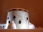
Cathcart Tower is a Martello tower located on Cedar Island in the St. Lawrence River, off the eastern shore of Fort Henry in Kingston, Ontario, Canada. It is one of four such towers built in the 1840s to protect Kingston's harbour and the entrance to the Rideau Canal. The other towers are: Fort Frederick, Shoal Tower, and Murney Tower. Alexander Mackenzie was a foreman on the construction of the Carthcart Tower and later went on to become Canada's second prime minister 1873–1878. It was his work crew whose boat capsized while returning from Cedar Island, drowning 17 men. Hamilton Cove was subsequently renamed Deadman's Bay. Built in 1848, this limestone tower is 11 m high and 16.5 m in diameter. It is surrounded by a shallow ditch and by a glacis extending to the shorelines on three sides. The guns of Cathcart Tower covered the eastern approaches of Kingston Harbour. The towers' construction was prompted by a dispute between Great Britain and the United States over the boundary between British Columbia and Oregon that threatened to lead to war (see Oregon crisis). When war was averted, Cathcart Tower was used for a time as a barracks for soldiers garrisoned at nearby Fort Henry. Eventually it was abandoned. The tower is now part of the Rideau Canal and Kingston Fortifications National Historic Site, the Rideau Canal and Kingston Fortifications UNESCO World Heritage Site, and is within the boundaries of Thousand Islands National Park (formerly St. Lawrence Islands National Park).The tower is reached by small water craft with a dock located on the north side of Cedar Island.