place

West Bank Light

1901 establishments in New York CityLighthouses completed in 1901Lighthouses in Staten IslandLighthouses on the National Register of Historic Places in New York CityNational Register of Historic Places in Staten Island
West Bank (NY) Light

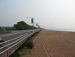
West Bank Light, officially West Bank Front Range Light, is a lighthouse in Lower New York Bay, within New York City, and acts as the front range light for the Ambrose Channel. It is currently active and not open to the public. The tower was built in 1901 and heightened in 1908. Staten Island Light serves as the rearrange. On May 29, 2007, the Secretary of the Interior identified West Bank Light, offshore in Ambrose Channel–Lower New York Bay, as surplus under the National Historic Lighthouse Preservation Act of 2000. The property was described as 55 feet (17 m) tall with two floors, a keeper's dwelling, and located on 0.1 acres (0.040 ha) of underwater area. The keeper's dwelling, located on the second story (about five standard stories above the ground), was 1,500 square feet (140 m2). It could be seen as far as the Riegelmann Boardwalk in Coney Island, Brooklyn, as well as from South Beach, Staten Island.No group was identified as willing and able to preserve the West Bank Light, and on June 5, 2008, the General Services Administration placed the light up for sale via auction with an initial bid was $10,000. The auction ended on August 27, 2008 at a final bid of $245,000. The sale did not close, and the light was auctioned a second time in September 2010, selling for $195,000 to Sheridan Reilly.

Excerpt from the Wikipedia article West Bank Light (License: CC BY-SA 3.0, Authors, Images).

West Bank Light
Beach 46th Street, New York Kings County

Geographical coordinates (GPS) Address Nearby Places
placeShow on map

Wikipedia: West Bank LightContinue reading on Wikipedia

Geographical coordinates (GPS)

Latitude Longitude
N 40.538 ° E -74.042805555556 °
placeShow on map

Address

Beach 46th Street
11224 New York, Kings County
New York, United States
mapOpen on Google Maps

West Bank (NY) Light
Share experience

Nearby Places

New York–New Jersey Harbor Estuary

The New York–New Jersey Harbor Estuary, also known as the Hudson-Raritan Estuary, is in the northeastern states of New Jersey and New York on the East Coast of the United States. The system of waterways of the Port of New York and New Jersey forms one of the most intricate natural harbors in the world and one of the busiest ports of the United States. The harbor opens onto the New York Bight in the Atlantic Ocean to the southeast and Long Island Sound to the northeast. Although the overall form of the estuary remains unchanged from the time of Giovanni da Verrazzano's visit in 1524, all parts have changed at least a little, and some parts, such as Hell Gate and Ellis Island, have been almost completely altered. In the greatest hidden change, the navigational channels have been deepened from the natural 17 feet (5.2 m) depth to 45 feet (14 m). In some places this required blasting of bedrock.There is an extremely complex system of tides and currents. Both the Bight and the Sound are essentially marine bodies with tides and saltwater, but the Sound compared to the Atlantic is about 20–30% less saline (as an estuary), and the tide is about 3 hours later with as much as 70% more variation. Rivers add a fresher, non-tidal inflow although the tide and brackishness extend well up rivers throughout the extended hydrologic system from Albany to Montauk Point to the Hudson Canyon region of the New York Bight. The New York Harbor Observing and Prediction System (NYHOPS) utilizes information from sensors, weather forecasts, and environment models to provide real-time forecasts of meteorological and oceanographic conditions in the area. Since the Ash Wednesday Storm of 1962 beaches along the shores of the East Coast have been regularly replenished with sand pumped in from off-shore. The United States Army Corps of Engineers (USACE) coordinates the projects.In 2016, USACE and the Port Authority of New York and New Jersey produced a comprehensive restoration plan for the New York Harbor region, with proposals to mitigate the effects of sea level rise through projects to restore natural areas. In September the USACE released the New York New Jersey Harbor and Tributaries Study (HATS).

East Shore Seawall
East Shore Seawall

The East Shore Seawall, also known as Staten Island Multi-Use Elevated Promenade, is a 5.2-mile (8.4 km) long combined seawall and esplanade proposed for the eastern shoreline of Staten Island, New York. It would run along the Lower New York Bay linking sections of the Gateway National Recreation Area: Fort Wadsworth at the north, Miller Field, and Great Kills Park to the south. It will roughly parallel Father Capodanno Boulevard and the South Beach–Franklin Delano Roosevelt Boardwalk. The coastal engineering strategy is to address climate change and sea level rise, and improve resilience along the shoreline of the New York–New Jersey Harbor Estuary and Port of New York and New Jersey. It will be built up to 6 metres (20 ft) above sea level and protect communities from coastal flooding of up to 15.6 feet (4.8 m) (two feet higher than that caused by Hurricane Sandy in 2012). It will includes 4.5 miles (7.2 km) of buried seawall, 0.6 miles (0.97 km) of earthen levee tie-in, 0.35 miles (0.56 km) miles vertical flood wall, more than 300 acres (120 ha) of natural storage, approximately 180 acres (73 ha) of ponding areas and 40 acres (16 ha) acres of tidal wetlands. It will also function as a linear park/greenway with recreational amenities including a boardwalk, biking and walking paths, and will provide access to public beaches.The project, a collaboration between the US Army Corps of Engineers and the New York State Department of Environmental Conservation, was first announced in May 2017. In 2019, the city allocated $615 million for its design and construction.Conflicts over environmental remediation has stalled the building of the project, originally projected to be completed in 2024.Federal legislation to expedite the construction of the seawall was passed in June 2022. It is expected to cost $1.5 billion. Construction was slated to begin at the end of that year.

New Creek (Staten Island)

The New Creek is an urban stream on the East Shore of Staten Island, New York City. The creek is fed by many natural springs in the area, which were used by the Lenape Indians before the arrival of European colonists in the 17th century. Many of the springs have been channeled underground by urban development as the population expanded throughout New York City and Staten Island. The New Creek watershed encompasses 2,249 acres (9.10 km2) and consists of marshland which supports a variety of flora and fauna. Spartina grass flourished in a tidal wetland before the restoration of the shore and beach area and the development of a shoreline urban park by the New York City Department of Parks and Recreation in the 1960s, blocking tidal flow to the area. Some of the indigenous flora include Rose Mallow, Soft Rush, and Bladder Sedge.The main channel originates at the Last Chance Pond Park and dominates the neighborhood of Midland Beach, with the surrounding watershed covering the neighborhoods of Dongan Hills, Grant City and Todt Hill. The west branch originates at the Boundary Avenue wetlands (Midland Field), and the east branch originates from southern end of Dongan Hills Avenue (and Patterson Avenue). The upper parts of the watershed are fed by Moravian Brook and Mersereau Valley, which feed the West and Main channels.Previous to the name New Creek, the branches had their own titles "including Perine’s Creek, Old Town Creek (aka Pole Creek), Barton’s Creek (aka Seaver’s Creek), and Barne’s Creek, which flowed out past Poppy Joe’s Island."The New York City Department of Environmental Protection (NYCDEP) has embarked on a vast Bluebelt project, which began in the 1990s and incorporates most of the east and south shores of Staten Island. In 2019 the New York City Department of Transportation and DEP began constriction on a $121 million enhancement. The project would award $33 million to put towards the "Gateway to the Bluebelt," creating a public viewing area and rehabilitate wetlands; $42 million towards expansion of the New Creek Bluebelt and would "create the largest wetland area in the entire Bluebelt system," and incorporates an upgraded storm sewer system, outfalls, stilling basins, micro pools, and weirs on and along the creek.