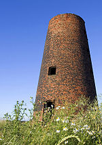
West Riding of Yorkshire

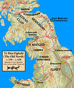
The West Riding of Yorkshire was one of three historic subdivisions of Yorkshire, England. From 1889 to 1974 the riding was an administrative county named County of York, West Riding. The lieutenancy at that time included the city of York and as such was named "West Riding of the County of York and the County of the City of York". The riding ceased to be used for administrative purposes in 1974, when England's local government was reformed. Contemporary local government boundaries in Yorkshire largely do not follow those of the riding. The entirety of South Yorkshire and West Yorkshire were historically within its the boundaries, as were the south-western areas of North Yorkshire (including Ripon), the Sedbergh area of Cumbria, the Barnoldswick and Slaidburn areas of Lancashire, and the part of the East Riding of Yorkshire around Goole.
Excerpt from the Wikipedia article West Riding of Yorkshire (License: CC BY-SA 3.0, Authors, Images).West Riding of Yorkshire
Acaster Avenue,
Geographical coordinates (GPS) Address Nearby Places Show on map
Geographical coordinates (GPS)
| Latitude | Longitude |
|---|---|
| N 53.86 ° | E -1.15 ° |
Address
Acaster Avenue
Acaster Avenue
YO23 7BP , Appleton Roebuck
England, United Kingdom
Open on Google Maps
