place

Kallio

Kallio
Helsinki districts Kallio

Kallio (Finnish: [ˈkɑlːio]; Swedish: Berghäll; literally "the rock") is a district and a neighbourhood in Helsinki, the capital of Finland, located on the eastern side of the Helsinki peninsula about one kilometre north from the city centre. It is one of the most densely populated areas in Finland. Kallio is separated from the city centre by the Siltasaarensalmi strait, over which is a bridge called Pitkäsilta ("long bridge"). Traditionally, the bridge symbolizes the divide between the affluent centre and the more working class areas around Kallio. After the forming of the new centre in the 19th century, the city expanded northward. The intense industrialization which began in the 1860s in Helsinki saw the construction of the industrial areas around Sörnäinen harbour and to the workers' district of Kallio, with the area becoming inhabited mostly by factory workers. However, most of the working-class families have long ago been replaced as the most typical Kallio residents by young adults and elderly people living alone, in a process which could be seen as some sort of gentrification. For many people who move into Helsinki from elsewhere in Finland, Kallio is the area where they first settle. Most flats are small, and rents are typically lower than elsewhere in central Helsinki, partly explaining the area's popularity among students and artists. The small flat sizes also mean that Kallio is expected to resist full gentrification. However, the rents have increased as the district has grown more popular and become an increasingly desirable area to live in. Kallio (and Harju, which is often considered a part of Kallio) also has, more than any other district in Helsinki, a reputation as a "bohemian" and liberal area. The area has a heterogeneous population and many bars. The area also has a number of sex shops, strip clubs and massage parlors. President Tarja Halonen was born in Kallio and lived there until she was elected president in 2000.

Excerpt from the Wikipedia article Kallio (License: CC BY-SA 3.0, Authors, Images).

Kallio
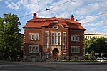
Itäinen Papinkatu, Helsinki Kallio (Central major district)

Geographical coordinates (GPS) Address Website Nearby Places
placeShow on map

Wikipedia: KallioContinue reading on Wikipedia

Geographical coordinates (GPS)

Latitude Longitude
N 60.184166666667 ° E 24.949166666667 °
placeShow on map

Address

Kallion kirkko

Itäinen Papinkatu 2
00530 Helsinki, Kallio (Central major district)
Finland
mapOpen on Google Maps

Website
helsinginkirkot.fi

linkVisit website

Helsinki districts Kallio
Share experience

Nearby Places

Linjat
Linjat

Linjat (Finnish), Linjerna (Swedish) is a neighborhood of the Kallio district of Helsinki, Finland. Its name literally means "The Lines" and comes from the five parallel streets named 1st, 2nd, 3rd, 4th and 5th Line (Ensi, Toinen, Kolmas, Neljäs and Viides linja (Finnish) / Första, Andra, Tredje, Fjärde, Femte linjen (Swedish)), which start at Hämeentie (Sw.: Tavastvägen) and run north-west, except for the much shorter Ensi linja, which starts at the southern end of Suonionkatu. The district lies to the north of Hakaniemi and Siltasaari and to the south of Alppiharju. The boundaries of Linjat are the eastern shore of Töölönlähti Bay (west), Helsinginkatu (north), Kaarlenkatu and Viides linja, cutting Karhupuisto Park in half (east) and Hämeentie (from Viides linja to Toinen linja), Toinen linja and Porthaninrinne (south). The area is served by the following public transport: Metro Hakaniemi metro station's northern exit is at the junction of Porthaninkatu, Siltasaarenkatu and Toinen linja. Tram Lines 3 and 9 run along Porthaninkatu, Viides linja and Kaarlenkatu, stopping at Kallion virastotalo (junction of Porthaninkatu and Toinen linja and Hakaniemi metro station northern exit), Karhupuisto (Viides linja) and Kaarlenkatu. In addition, lines 6 and 7 run along Hämeentie, stopping at Haapaniemi (corner of Viides linja). Also, tramlines 1 and 8 run along Helsinginkatu to the north of Linjat. Tram stops Castreninkatu, Kuntatalo and Ensi linja are located at Ensi linja and Toinen linja. There is no regular traffic for them nowadays, but the tram tracks and the stops still exist. They can be used if the tram lines are on an exceptional route. Bus Many routes leading to Vantaa, including the 615 to Helsinki-Vantaa Airport, run along Hämeentie, stopping at the Haapaniemi stop (from Helsinki: on the corner of Haapaniemenkatu; from airport: on the corner of Neljäs linja). Route 51 (Hakaniemi - Konala) runs along Porthaninkatu, stopping at Helsingin virastotalo tram stop, before continuing onto Fleminginkatu, Franzéninkatu and Kaarlenkatu. Routes 23 (Helsinki Central Railway Station - Ruskeasuo), 53 (Hakaniemi - Munkkiniemi) and 503 (Merihaka - Matinkylä (Espoo)) run along Toinen linja and Alppikatu, stopping at Kallion virastotalo, Castréninkatu (Toinen linja 25), Kuntatalo (Toinen linja 33) and Wallininkatu (Alppikatu 9). Culture and education Kallio library is situated at Viides linja 11, just across the boundary in the Torkkelinmäki sub-district. Kallio Primary School (Kallion ala-aste) is at Neljäs linja 11–15. The Helsinki City Theatre (Helsingin kaupunginteatteri) is at Ensimmäinen linja 2.

Hakaniemi market square

The Hakaniemi market square (Finnish: Hakaniementori, Swedish: Hagnäs torg) is a market square located in Hakaniemi, Helsinki, Finland, opened in 1897. Throughout its history, there have been numerous Vappu marches and demonstrations starting from the square, and it is an integral part of the history of the Finnish workers' movement. Many buildings near the square have been owned by Elanto and trade unions. The most famous buildings near the square are the circular Ympyrätalo office building and the Hakaniemi market hall. Opposite them, on the southern edge of the square, is the Metallitalo building. The Hakaniemi market square was originally built on reclaimed land, located where there used to be a strait separating Siltasaari from the mainland. The square was founded to support all kinds of trade. The first merchants appeared on the square in time for Christmas 1897. All kinds of food from berries to game are sold on the square. The services on the square expanded in the early 20th century, when tailors and cloth sellers appeared on the square; fishmongers came in the 1920s. During World War II the square was full of stacks of firewood as the nearby houses needed warming. In 1979 the square was renovated and repaved with cobblestones.The firewood stacks brought to the square were burned in a demonstration organised by the Finland–Soviet Union Peace and Friendship Society on 6 August 1940, which is known as "pinonpolttajaiset" ("the burning of the stacks").There is trade going on at the market square on every weekday. It also hosts a fair on the first Sunday of every month.A temporary glass pavilion was built at the square during the renovation of the Hakaniemi market hall for the market sellers, starting from 2017. The city council approved the plan in June 2016.