Shirehampton

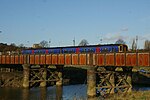
Shirehampton is a district of Bristol in England, near Avonmouth, at the northwestern edge of the city. It originated as a separate village, retains a High Street with a parish church and shops, and is still thought of as a village by many of its 6,867 inhabitants. Although on the far northwest corner, and largely separated from the rest of Bristol by a broad swathe of parkland extending from the Blaise Castle estate, with the River Avon forming a barrier for access to Somerset, the community is still a convenient location from which to reach all parts of the city. Travel is also easy from Shirehampton into Gloucestershire, South Wales and Somerset since it lies within reach of the main motorways in the area, including the M5, the M4 Second Severn Crossing, and the M49, and it is served by the A4 Portway and by Shirehampton railway station, which allow access to near the city centre. It is informally known to local people as "Shire".
Excerpt from the Wikipedia article Shirehampton (License: CC BY-SA 3.0, Authors, Images).Shirehampton
Barrowmead Drive, Bristol Lawrence Weston
Geographical coordinates (GPS) Address Nearby Places Show on map
Geographical coordinates (GPS)
| Latitude | Longitude |
|---|---|
| N 51.4945 ° | E -2.6712 ° |
Address
Barrowmead Drive 121
BS11 0JH Bristol, Lawrence Weston
England, United Kingdom
Open on Google Maps


