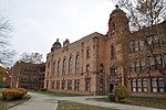
Rosedale Park, Detroit
1916 establishments in MichiganColonial Revival architecture in MichiganHistoric districts in DetroitHistoric districts on the National Register of Historic Places in MichiganNRHP infobox with nocat ... and 3 more
National Register of Historic Places in DetroitNeighborhoods in DetroitUse mdy dates from August 2023

Rosedale Park is a historic district located in Detroit, Michigan. It is roughly bounded by Lyndon, Outer Drive, Grand River Avenue, Southfield Freeway, Glastonbury Avenue, Lyndon Street and Westwood Drive. It was listed on the National Register of Historic Places in 2006. The Rosedale Park district has the largest number of individual properties of any district nominated to the National Register of Historic Places in Michigan, with 1533.The district contains primarily brick houses, and was largely developed from the late 1920s through the 1940s.
Excerpt from the Wikipedia article Rosedale Park, Detroit (License: CC BY-SA 3.0, Authors, Images).Rosedale Park, Detroit
Stahelin Road, Detroit
Geographical coordinates (GPS) Address Nearby Places Show on map
Geographical coordinates (GPS)
| Latitude | Longitude |
|---|---|
| N 42.400277777778 ° | E -83.226944444444 ° |
Address
Stahelin Road
Stahelin Road
48223 Detroit
Michigan, United States
Open on Google Maps


