place

St Stephens by Launceston Rural

Civil parishes in CornwallLaunceston, CornwallVillages in Cornwall
St Stephens Church geograph.org.uk 323391

St Stephens by Launceston Rural is a civil parish in the east of Cornwall, England, United Kingdom. It is in the Registration district of Launceston. The population of the parish in the 2001 census was 312, increasing to 360 and including Dutson at the 2011 census. The former parish of St Stephens by Launceston was abolished in 1894: St Stephens by Launceston Urban became part of the town of Launceston, while St Stephens by Launceston Rural became part of Launceston Rural District.The parish lies immediately north west of the town of Launceston and is bounded to the south by the parishes of Launceston, St Thomas the Apostle Rural, and Lawhitton. To the east it is bounded by the River Tamar (the border between Cornwall and Devon). To the north and north-west it is bordered by the parishes of Werrington, North Petherwin and Egloskerry.

Excerpt from the Wikipedia article St Stephens by Launceston Rural (License: CC BY-SA 3.0, Authors, Images).

St Stephens by Launceston Rural
Duke Street,

Geographical coordinates (GPS) Address Nearby Places
placeShow on map

Wikipedia: St Stephens by Launceston RuralContinue reading on Wikipedia

Geographical coordinates (GPS)

Latitude Longitude
N 50.647 ° E -4.371 °
placeShow on map

Address

Duke Street
PL15 8HD
England, United Kingdom
mapOpen on Google Maps

St Stephens Church geograph.org.uk 323391
Share experience

Nearby Places

Launceston, Cornwall

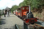
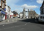
Launceston ( LAHN-stən, LAWN-, locally LA(H)N-sən; rarely spelled Lanson as a local abbreviation; Cornish: Lannstevan) is a town, ancient borough, and civil parish in Cornwall, England, United Kingdom. It is 1 mile (1.6 km) west of the middle stage of the River Tamar, which constitutes almost the entire border between Cornwall and Devon. The landscape of the town is generally steep particularly at a sharp south-western knoll topped by Launceston Castle. These gradients fall down to the River Kensey and smaller tributaries. The town centre itself is bypassed and is no longer physically a main thoroughfare. The A388 still runs through the town close to the centre. The town remains figuratively the "gateway to Cornwall", due to having the A30, one of the two dual carriageways into the county, pass directly next to the town. The other dual carriageway and alternative main point of entry is the A38 at Saltash over the Tamar Bridge and was completed in 1962. There are smaller points of entry to Cornwall on minor roads. Launceston Steam Railway narrow-gauge heritage railway runs as a tourist attraction during the summer months. It was restored for aesthetic and industrial heritage purposes and runs along a short rural route, it is popular with visitors but does not run for much of the year. Launceston Castle was built by Robert, Count of Mortain (half-brother of William the Conqueror), c. 1070 to control the surrounding area. Launceston was the caput of the feudal barony of Launceston and of the Earldom of Cornwall until replaced by Lostwithiel in the 13th century. Launceston was later the county town of Cornwall until 1835 when Bodmin replaced it. Two civil parishes serve the town and its outskirts, of which the central more built-up administrative unit housed 8,952 residents at the 2011 census.Three electoral wards include reference to the town, their total population, from 2011 census data, being 11,837 and two ecclesiastical parishes serve the former single parish, with three churches and a large swathe of land to the north and west part of the area. Launceston's motto "Royale et Loyale" (English translation: Royal and Loyal) is a reference to its adherence to the Cavalier cause during the English Civil War of the mid-17th century.