County of Rietberg
1807 disestablishmentsCounties of the Holy Roman EmpireFormer states and territories of North Rhine-WestphaliaLower Rhenish-Westphalian CircleStates and territories established in 1237

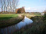
The County of Rietberg (German: Grafschaft Rietberg) was a state of the Holy Roman Empire, located in the present-day German state of North Rhine-Westphalia. It was situated on the upper Ems in Westphalia, between the Prince-Bishopric of Paderborn and the Prince-Bishopric of Münster. It existed as an independent territory from 1237 to 1807, when it was mediatised to the Kingdom of Westphalia.
Excerpt from the Wikipedia article County of Rietberg (License: CC BY-SA 3.0, Authors, Images).County of Rietberg
Schloßstraße,
Geographical coordinates (GPS) Address Nearby Places Show on map
Geographical coordinates (GPS)
| Latitude | Longitude |
|---|---|
| N 51.8 ° | E 8.4333333333333 ° |
Address
Rietberger Fischteiche
Schloßstraße
33397 , Rietberg
North Rhine-Westphalia, Germany
Open on Google Maps


