place

Fishergate

Streets in YorkUse British English from August 2017Villages and areas in the City of York
Fishergate, York
Fishergate, York

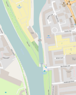
Fishergate is a street and surrounding area of York, England.

Excerpt from the Wikipedia article Fishergate (License: CC BY-SA 3.0, Authors, Images).

Fishergate
Fulford Road, York Fishergate

Geographical coordinates (GPS) Address Nearby Places
placeShow on map

Wikipedia: FishergateContinue reading on Wikipedia

Geographical coordinates (GPS)

Latitude Longitude
N 53.946 ° E -1.072 °
placeShow on map

Address

Fulford Road Police Station

Fulford Road
YO10 4BY York, Fishergate
England, United Kingdom
mapOpen on Google Maps

Fishergate, York
Fishergate, York
Share experience

Nearby Places

Pikeing Well
Pikeing Well

The Pikeing Well, occasionally known as Lady Well, is a well in the city of York, in England. The well lies on New Walk, which runs along the east bank of the River Ouse, Yorkshire, running south from the city centre. The walk was laid out in the 1730s, as an attraction for visitors to the city. By the 1750s, mineral water spas were popular places to visit. York did not have mineral water springs, so the city council instead decided to commission a decorative wellhead over an existing well. It claimed that the water was useful for healing illness related to the eye.The wellhead was designed by John Carr of York, its form inspired by grottos. He reused Mediaeval stonework, which is sometimes said to have come from the chancel of All Saints' Church, but must have come from another source, as the chancel was not demolished until 1782. The commission was for £88 13 shillings, but Carr's fee was reduced by £25 in exchange for granting him the Freedom of the City.The building is small and rectangular, with a semicircular niche at the rear, and a round-headed door facing the river. It is built of a mixture of limestone and sandstone. There is a parapet, which incorporates a broken 12th-century capital. There is a barrel roof, now covered in asphalt. Inside, the floor is covered in flagstones, and in the centre is a stone-lined pool, with steps down to it.The well was closed by the Ministry of Health in 1929, at which time, an iron gate was placed over the pool. The building was Grade II* listed in 1954, and it was restored in 2000.

Bowes Morrell House
Bowes Morrell House

The Bowes Morrell House is a historic building on Walmgate in the city centre of York, in England. The house was one of four for which a licence was granted in 1396 to construct in the churchyard of St Peter-le-Willows. It may have been used as a vicarage for the church, or alternatively for St Margaret's Church. In later years, the building was a cheap lodging house for travelling workers. By the late 19th-century, it was owned by the O'Hara family, bought out by the Kilmartin family in the 1930s. It was nicknamed the "doss house", and had a sign above the door reading "good lodgings down this passage", despite its reputation for poor-quality accommodation.The house is timber framed, with two stories, and originally had an L plan, with the main section being a hall 20 feet long and 10-and-a-half feet wide. An extension was built in the 16th century, giving the building a square plan. In the late-17th century, a further extension was added in brick to the south end of the original building, while the current second floor over the hall dates from the 18th century. The crown post roof survives, as does much of its timber framing, although some has been renewed.The house was partially restored in 1932. In 1954, it was Grade II* listed, and in 1966, it was bought and more thoroughly restored by the York Civic Trust. It renamed the building after John Bowes Morrell, one of its founders. It was later occupied by the Council for British Archaeology. In 2004, it was purchased by the York Conservation Trust, and from 2012 it was occupied by the Cyrenians drug and alcohol rehabilitation charity.