place

Pen-y-Gwryd

BeddgelertMountain passes of GwyneddMountain passes of SnowdoniaRoads in GwyneddRoads in Snowdonia
Tourism in GwyneddTourism in SnowdoniaUse British English from January 2015
Pyg old
Pyg old

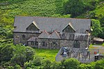
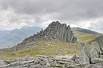
Pen-y-Gwryd is a pass at the head of Nantygwryd and Nant Cynnyd rivers close to the foot of Snowdon in Gwynedd, Wales. The area is located at the junction of the A4086 from Capel Curig to Llanberis and Caernarfon and the A498 from Beddgelert and Nant Gwynant about a mile from the head of the Llanberis Pass. It is close to the boundary with Conwy county borough in northern Snowdonia. The famous mountaineering hostelry, Pen-y-Gwryd Hotel, is located in the pass. It is also a mountain rescue post with links to the other rescue posts at Ogwen Cottage and Plas y Brenin. The Old Miners' Track from the Snowdon copper mines are now part of the modern A4086 road between Pen-y-Gwryd and Pen-y-Pass. It continues northwards beyond Pen-y-Gwryd skirting Glyder Fach to Bwlch Tryfan and Dyffryn Ogwen. From Pen-y-Pass is the "PYG track", one of the many routes leading to the summit of Snowdon, its name is believed be derived from the initials ("P-y-G"). However, older maps show it as the "Pig track", a name derived from Bwlch y Moch (the Pigs' Gap).

Excerpt from the Wikipedia article Pen-y-Gwryd (License: CC BY-SA 3.0, Authors, Images).

Geographical coordinates (GPS)

Latitude Longitude
N 53.08256 ° E -4.00203 °
placeShow on map

Address

Pen-y-Gwryd Hotel

A4086
LL55 4NT
Wales, United Kingdom
mapOpen on Google Maps

Website
pyg.co.uk

linkVisit website

linkWikiData (Q7162064)
linkOpenStreetMap (236865835)

Pyg old
Pyg old
Share experience

Nearby Places

Cantref Arfon
Cantref Arfon

The mediaeval Welsh cantref of Arfon in north-west Wales was the core of the Kingdom of Gwynedd. Later it was included in the new county of Caernarfonshire, together with Llŷn and Arllechwedd under the terms of the Statute of Rhuddlan in 1284. The island of Anglesey faced it across the Menai Strait; to the east was the cantref of Arllechwedd, to the south the cantref of Eifionydd (which, together with Ardudwy, was part of the earlier kingdom of Dunoding), and to the west was the cantref of Llŷn. As the name suggests, Arfon faces Anglesey (Môn) (see soft mutation) across the Menai, and controls access to that strategic strait which has played an important part in Welsh history. Broadly speaking, it stretched from the peaks of Yr Eifl in the west to Afon Cegin, a stream just east of Bangor, and inland from the shores of the Menai southwards into the heart of Snowdonia (Eryri), including Dyffryn Nantlle and the strategic Llanberis Pass. In geographical terms, the cantref was very variable, including fertile land and rich pastures on the shore of the Menai and in the valleys, a number of woods on the slopes and mountains to the south, and the highest mountains in Wales such as Snowdon and Tryfan. Arfon comprised two commotes, which were apparently created later in its history: Arfon Is Gwyrfai and Arfon Uwch Gwyrfai, whose boundary was the Gwyrfai River. During the Iron Age and the Roman era, it was part of the territory of the Ordovices. The Roman fort of Segontium and the Dinorwig hill fort were located there. The main defensive fortress in the era of the Welsh princes was Dolbadarn Castle, near modern Llanberis. Important ecclesiastical centres were to be found in Bangor and Clynnog Fawr. The bishops of Bangor, the successors of St Deiniol, had an extensive holding of land in the north-east of the cantref. This was known as Maenol Bangor, but its status as an administrative unit within Arfon is uncertain. Clynnog owned broad lands in Llŷn and Anglesey. Arfon features prominently in Welsh mythology, particularly in the Fourth Branch of the Mabinogi. Math fab Mathonwy's court at Caer Dathyl was located there, as was Aranrhod's at Caer Aranrhod. The battle between the forces of Math and Pryderi took place in Arfon. Lleu Llaw Gyffes flies to Nantlleu in Arfon in the form of an eagle after his attempted murder by Gronw Pebr.A local government district of the same name existed from 1974 to 1996, when Gwynedd became a unitary authority. The name Arfon itself is still used for the area, as it has been for centuries in Wales.

Pen-y-Pass
Pen-y-Pass

Pen-y-Pass is a mountain pass in Snowdonia, Gwynedd, north-west Wales. It is a popular location from which to walk up Snowdon, as three of the popular routes (the Miners Track, the Pyg Track and the ascent via Crib Goch) can be started here. Glyder Fawr, to the north, is also accessible from here. Situated at the high point of the Llanberis Pass at an elevation of 359 metres (1,178 ft) – about a third of the height of Snowdon – the road was built in the 1830s to allow ore from the mines on Snowdon to be transported to Llanberis. It would be taken down the Miners Track to a store-house at Pen-y-Pass first. Previously, the miners had had to move the ore over the Snowdon summit and down to Beddgelert, which is located at around a third the height of Snowdon. The Llanberis pass road extends beyond Pen-y-Pass to join the Beddgelert-to-Capel Curig road at the Pen-y-Gwryd hotel. That notable climbing hotel was used as a base by Sir John Hunt, Baron Hunt and his team whilst training for the successful 1953 expedition to Mount Everest and equipment and autographs from that and other expeditions may be seen in the Everest Room. The former Gorphwysfa Hotel at Pen-y-Pass is now a youth hostel, bar and café operated by YHA, and opposite is an information centre and café and a Snowdonia National Park-run car park. There is also a car park half way down Llanberis Pass in Nant Peris village as well as others in Llanberis village. There is a park and ride bus service to Pen-y-pass car park, which is the hub of the year-round Sherpa bus network provided by Express Motors and GHA Coaches. This service links Pen-y-Pass to Llanberis, Capel Curig, Betws-y-Coed, Beddgelert, Porthmadog, Rhyd Ddu and Waunfawr.