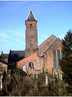
Fenn's, Whixall and Bettisfield Mosses National Nature Reserve

Fenn's, Whixall and Bettisfield Mosses National Nature Reserve is a national nature reserve (NNR) which straddles the border between England and Wales, near Whixall and Ellesmere in Shropshire, England and Bettisfield in Wrexham County Borough, Wales. It comprises three peat bogs, Bettisfield Moss, Fenn's Moss and Whixall Moss. With Wem Moss (also an NNR) and Cadney Moss, they are collectively a Site of Special Scientific Interest called The Fenn's, Whixall, Bettisfield, Wem & Cadney Moss Complex and form Britain's third-largest lowland raised bog, covering 2,388 acres (966 ha). The reserve is part of the Midland Meres and Mosses, an Important Plant Area which was declared a Wetland of International Importance under the Ramsar Convention in 1997. It is also a European Special Area of Conservation. The mosses form an ombrotrophic raised bog, since the only source of water is from rainfall. Peat is formed when the remains of living plants, particularly Sphagnum, decompose in conditions where there is little oxygen, resulting in layers of peat up to 26 feet (7.9 m) thick in places, although this has been greatly reduced by commercial harvesting of the peat in many areas. In their natural state, such mosses form a dome of peat which can be up to 33 feet (10 m) higher than the surrounding surface, but the domes collapsed as a result of the drainage ditches created to allow harvesting to take place. Three major enclosures of the mosses have taken place, the first as a result of a voluntary agreement signed in 1704, and ratified by the High Court of Chancery in 1710 when opposition prevented the original plans from being carried out. Two Parliamentary enclosures, each authorised by an Act of Parliament were implemented in 1775 on Fenn's Moss and in 1823 on Whixall Moss. Both resulted in common rights being removed and gave the landlords powers which paved the way for the subsequent commercial exploitation of the mosses. In the early 1800s, the Ellesmere Canal Company built a canal across the southern edge of Whixall Moss. The engineers realised that maintenance would be required, to prevent the formation from sinking into the bog, and a gang of navvies, known as the Whixall Moss Gang, were employed continuously from 1804 to the early 1960s, to keep building up the banks of the canal, now renamed the Llangollen Canal. In the 1960s, the engineering issues were solved, when steel piling was used to underpin this section. The Oswestry, Ellesmere and Whitchurch Railway also planned to cross the mosses, despite being ridiculed by the Great Western Railway for believing that such a thing was possible. They built their line across the north-western edge of Fenn's Moss in 1862, having cut drains in late 1861, and then put layers of heather, wooden faggots and sand on the formation, to allow it to float on the peat. Trains ran from 1862 until the 1960s, without sinking into the mire. Commercial cutting of peat began in 1851, and a series of six peat works were built over the years, as companies came and went. In order to extract the peat, a network of 2 ft (610 mm) gauge tramways were used, with wagons pulled by horses. The first internal combustion locomotive was bought in 1919, to replace the horses, and three more locomotives were purchased in 1967 and 1968 but did not last long, as the tramway ceased to be used in 1970, to be replaced by Dexta tractors pulling trailers. Mechanised peat cutters were also introduced in 1968. By this time, all of the harvested peat was sold through the retail chain Woolworths, for use in horticulture. The Hanmer Estate, owners of Fenn's Moss, quadrupled the rents in 1989, and the existing operation was bought out by Croxden Horticultural Products. They geared up to extract much larger volumes of peat, to meet the increased rents, but opposition to using peat was increasing, and in late December 1990, the leases were bought by the Nature Conservancy Council, bringing an end to commercial peat cutting. Since then, the mosses have been managed by Natural England and Natural Resources Wales, who have blocked up drainage ditches and removed scrub, allowing water levels to rise, and the ombrotrophic bog to re-establish itself. Circular waymarked trails have been created through some areas of Fenn's and Whixall Mosses, and on Bettisfield Moss, to allow the nature reserve to be appreciated by visitors.
Excerpt from the Wikipedia article Fenn's, Whixall and Bettisfield Mosses National Nature Reserve (License: CC BY-SA 3.0, Authors, Images).Fenn's, Whixall and Bettisfield Mosses National Nature Reserve
Canal Side,
Geographical coordinates (GPS) Address External links Nearby Places Show on map
Geographical coordinates (GPS)
| Latitude | Longitude |
|---|---|
| N 52.92 ° | E -2.76 ° |
Address
Fenn's, Whixall, Bettisfield Mosses National Nature Reserve
Canal Side
SY13 2RX
England, United Kingdom
Open on Google Maps


