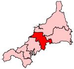
St Columb Road

St Columb Road (Cornish: Fordh Sen Kolomm) is a small village near Fraddon and Indian Queens in Cornwall, England, United Kingdom. It lies half a mile (750m) from the A30 road. St Columb Road railway station is on the branch line from Par to Newquay. When it opened in 1876 the station was called Halloon. It was renamed soon afterwards to reflect the existence of St Columb Major further north, and the new name was adopted for the local settlement which followed. In 2007 following the world record pub quiz, the title of the brightest pub in Cornwall was awarded to the Queen and Railway at St Columb Road. However, the pub had the fewest and smallest teams but the highest average score per person.
Excerpt from the Wikipedia article St Columb Road (License: CC BY-SA 3.0, Authors, Images).St Columb Road
Newquay Road,
Geographical coordinates (GPS) Address Nearby Places Show on map
Geographical coordinates (GPS)
| Latitude | Longitude |
|---|---|
| N 50.39637 ° | E -4.94061 ° |
Address
Newquay Road
Newquay Road
TR9 6PY , St. Enoder
England, United Kingdom
Open on Google Maps


