Presidency division
Divisions of West Bengal

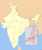
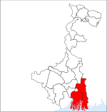
Presidency division is an administrative division within the Indian state of West Bengal. The headquarters and the largest city of the Presidency division is Kolkata, the state capital. Presidency division is bounded by Medinipur division to South-West, Burdwan division to North-West and Malda division to North. The whole east side of the division is covered by India–Bangladesh border.
Excerpt from the Wikipedia article Presidency division (License: CC BY-SA 3.0, Authors, Images).Presidency division
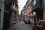
Chatterjee Lane, Kolkata Bowbazar
Geographical coordinates (GPS) Address Nearby Places Show on map
Geographical coordinates (GPS)
| Latitude | Longitude |
|---|---|
| N 22.5726723 ° | E 88.3638815 ° |
Address
Chatterjee Lane
Chatterjee Lane
700073 Kolkata, Bowbazar
West Bengal, India
Open on Google Maps


