place

Brooklyn, California

1856 establishments in California1872 disestablishments in CaliforniaAlameda County, California geography stubsFormer municipalities in CaliforniaNeighborhoods in Oakland, California
Populated places established in 1856
1857 U.S. Coast Survey Map of San Antonio Creek and Oakland, California (near San Francisco) Geographicus SanAntonioCreek uscs 1857

Brooklyn is a former city in Alameda County, California, now annexed to Oakland, California. Brooklyn first formed from the amalgamation in 1856 of two settlements, the sites of which are both now within the city limits of Oakland: San Antonio and Clinton. The name Brooklyn commemorated the ship that had brought Mormon settlers to California in 1846. In 1870, Brooklyn absorbed the nearby town of Lynn, which housed a footwear industry, and incorporated as a city.The San Francisco and Oakland Railroad had built a station at San Antonio. When the Central Pacific Railroad took over the line in 1870, the name was changed to Brooklyn.In 1872, voters approved their city's annexation by Oakland. Afterward, when the Southern Pacific Railroad took over the rail line in 1883, the Brooklyn station name was changed to East Oakland.A post office was opened in Brooklyn in 1855; it became a branch of the Oakland post office in 1878.Looking at historical maps, Brooklyn is shown as a fairly large area, lying adjacent and to the south of Lake Merritt and the Piedmont tract, and adjacent and to the north of Alameda, the San Leandro Creek, and the town of San Leandro. Today this is East Oakland.

Excerpt from the Wikipedia article Brooklyn, California (License: CC BY-SA 3.0, Authors, Images).

Brooklyn, California
East 8th Street, Oakland

Geographical coordinates (GPS) Address Nearby Places
placeShow on map

Wikipedia: Brooklyn, CaliforniaContinue reading on Wikipedia

Geographical coordinates (GPS)

Latitude Longitude
N 37.788538888889 ° E -122.24941388889 °
placeShow on map

Address

East 8th Street

East 8th Street
94606 Oakland
California, United States
mapOpen on Google Maps

1857 U.S. Coast Survey Map of San Antonio Creek and Oakland, California (near San Francisco) Geographicus SanAntonioCreek uscs 1857
Share experience

Nearby Places

Mr. Floppy's Flophouse

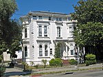
Mr. Floppy's Flophouse was a mansion in East Oakland that at one time housed a bordello and saloon patronized by writer Jack London; in later years a picture of the writer was placed behind the elegant bar. In the early 1990s it was also the home to a well-known, wild underground party and rave. Mr. Floppy himself was said to be an elusive archeologist from Finland who, when not busy excavating an inverted pyramid thought to house the knowledge of all mankind, was hosting late night events in the bowels of one of Oakland's most notorious districts. The party that never happened, "Go Native" was shut down from Native American communities in Texas from online social networks! Picketers and some representing the party stood ground the night the party was held. That night sparked them all which began a slew of parties ranging from psytrance to dubstep around 2009. The flophouse had around 15-20 different rooms, with something different going on in each. In the main ballroom, DJ's and acts such as Psychic TV or Olli Wisdom would perform, while upstairs boasted any variety of acts ranging from a naked man playing sitar, to freestyle house, to a black light mushroom garden paradise. The organizers were granted by the City of Oakland all needed permits to host the events. It was the goal of the organizers to provide a fun and safe atmosphere for its patrons. At dawn it was not uncommon for George, the owner of the property, to appear in a wizard cape serving shrimp cups or noodle soups from behind his piano.