River Wear
Pages including recorded pronunciationsRivers of County DurhamRivers of Tyne and WearVague or ambiguous geographic scope from December 2012

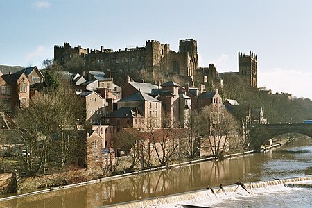
The River Wear ( (listen), WEER) in North East England rises in the Pennines and flows eastwards, mostly through County Durham, to the North Sea in the City of Sunderland. At 60 mi (97 km) long, it is one of the region's longest rivers. The Wear wends in a steep valley through the cathedral city of Durham and gives its name to Weardale in its upper reach and Wearside by its mouth.
Excerpt from the Wikipedia article River Wear (License: CC BY-SA 3.0, Authors, Images).River Wear
South Pier, Sunderland Roker Marina
Geographical coordinates (GPS) Address Nearby Places Show on map
Geographical coordinates (GPS)
| Latitude | Longitude |
|---|---|
| N 54.916 ° | E -1.3577 ° |
Address
South Pier
South Pier
SR1 2BT Sunderland, Roker Marina
England, United Kingdom
Open on Google Maps


