Hopfgarten im Brixental
Cities and towns in Kitzbühel DistrictKitzbühel AlpsTyrol geography stubs

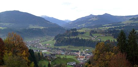
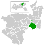
Hopfgarten im Brixental is a market town in the Austrian state of Tyrol in the Kitzbühel district. It is located at an elevation of 622 m above sea level. With an area of 166.57 km² it is the largest municipality in the district, and among the largest in Tyrol.
Excerpt from the Wikipedia article Hopfgarten im Brixental (License: CC BY-SA 3.0, Authors, Images).Hopfgarten im Brixental
Lindrainweg,
Geographical coordinates (GPS) Address Nearby Places Show on map
Geographical coordinates (GPS)
| Latitude | Longitude |
|---|---|
| N 47.45 ° | E 12.166666666667 ° |
Address
Lindrainweg
6361
Tyrol, Austria
Open on Google Maps


