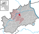
Ahrweiler (district)
Ahrweiler (district)All pages needing cleanupDistricts of PrussiaDistricts of Rhineland-PalatinateJewish German history ... and 1 more
Wikipedia pages needing cleanup from January 2020
Ahrweiler (German: [ˈaːɐ̯ˌvaɪlɐ]) is a district in the north of Rhineland-Palatinate, Germany. It is bounded by (from the north and clockwise) the districts of Euskirchen, Rhein-Sieg and the city of Bonn in the state of North Rhine-Westphalia, and the districts of Neuwied, Mayen-Koblenz and Vulkaneifel.
Excerpt from the Wikipedia article Ahrweiler (district) (License: CC BY-SA 3.0, Authors).Ahrweiler (district)
Franz-Wenzel-Straße,
Geographical coordinates (GPS) Address Nearby Places Show on map
Geographical coordinates (GPS)
| Latitude | Longitude |
|---|---|
| N 50.533333333333 ° | E 7.0833333333333 ° |
Address
Franz-Wenzel-Straße 12
53474 , Ahrweiler
Rhineland-Palatinate, Germany
Open on Google Maps
