place

Furneux Pelham

Civil parishes in HertfordshireEast Hertfordshire DistrictFurneux PelhamVillages in Hertfordshire
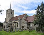
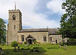
Furneux Pelham Time Flies and Mind Your Business... geograph.org.uk 86513

Furneux Pelham or Furneaux Pelham is a village and civil parish in Hertfordshire, England. The village is one of the Pelhams, part of an early medieval larger swathe of land known as Pelham including Brent Pelham to the north and Stocking Pelham to the east and north-east. The village is largely linear covering much of the width of the parish from east to west and is buffered by gently sloped fields with some woodland to all sides. It is known for its ford (Violet's Lane) to the north along the upper Ash which is over 1 kilometre (1,100 yd) long traversable by 4x4 enthusiasts most of the year and in the periods of least flow by experienced off-road motorcyclists.

Excerpt from the Wikipedia article Furneux Pelham (License: CC BY-SA 3.0, Authors, Images).

Furneux Pelham
The Causeway, East Hertfordshire Furneux Pelham

Geographical coordinates (GPS) Address Nearby Places
placeShow on map

Wikipedia: Furneux PelhamContinue reading on Wikipedia

Geographical coordinates (GPS)

Latitude Longitude
N 51.931 ° E 0.08 °
placeShow on map

Address

The Causeway

The Causeway
SG9 0LW East Hertfordshire, Furneux Pelham
England, United Kingdom
mapOpen on Google Maps

Furneux Pelham Time Flies and Mind Your Business... geograph.org.uk 86513
Share experience

Nearby Places

Albury, Hertfordshire

Albury is a village and civil parish in the East Hertfordshire district of Hertfordshire, England, about five miles west of Bishop's Stortford. According to the 2001 census it had a population of 537, increasing in the 2011 Census to 595.Albury lies between Little Hadham to the south and Furneux Pelham to the north and includes the hamlets Albury End, Clapgate, Patmore Heath and Upwick Green. The 1894–1895 edition of The Comprehensive Gazetteer of England and Wales listed the hamlets: Albury End, Church End, Clapgate, Gravesend, Patmore Heath, and Upwich. An earlier gazetteer, the Imperial Gazetteer of England and Wales dated 1870–1872 stated that the north-lying Patient-End is an Albury hamlet. Gravesend and Patmore Heath are 400 metres apart. The name "Albury" derives from the Old English ald (old) and burh (fortification).To the northwest of the village stood Albury Hall, a three-storey manor house believed to have been re-built by MP John Calvert, around 1780 after an earlier house was demolished. Calvert's son, also named John and also an MP, inherited it in 1808, and successive owners modified the house, the army requisitioned it during World War II, and it was demolished around 1950.There is one public house in Albury, The Catherine Wheel which dates from c.1765. The original building was destroyed by fire in 2004 and a replacement building on the same site reopened in 2007. Historically there were another four public houses in Albury, The Fox at Albury End (closed late 1970s), The Labour in Vain at Church End (closed in the 1950s), The Royal Oak at Clapgate (closed 1985) and Jolly Butchers at Clapgate (closed c.1900).

Anstey, Hertfordshire

Anstey is a village and civil parish in the East Hertfordshire district of Hertfordshire, England, about 15 miles (24 km) northeast of Stevenage. According to the 2001 census the population of the parish was 338, reducing to 299 at the 2011 census.The name "Anstey" derives from the Old English ān (narrow, or one-way) and stīg (footpath).There are at least two books on the history of this village. The first is Anstey, a Hertfordshire Parish, written in 1929 by Rev Frank Ricardo Williams, MA, who was the rector from 1907 to 1928 (died 19 May 1937). The second is Anstey: Our True Surname Origin and Shared Medieval Ancestry by GM Anstey and TJ Anstey in which it is shown that all bearers of the surname 'Anstey' worldwide can trace their surname origin to Anstey in Hertfordshire. The Church of England parish church of Saint George is a cruciform building of flint with stone dressings. Its earliest parts are the chancel, transepts and crossing tower, all of which were built in the 12th century. The church was altered in the 13th century and the nave was rebuilt in the 14th century. The south porch and the top stage of the tower are 15th century. The church was restored in 1871–72 under the direction of the Gothic Revival architect William Butterfield. Repairs in 1907 were directed by the architect Arthur Blomfield. St George's is a Grade I listed building. The lychgate is a separate Grade II listed building, as it incorporates a lockup which was apparently used until the beginning of the 20th century.In his book 'England's Thousand best churches' (revised edition 2002), Simon Jenkins refers to a near-miss when a fully-loaded WW2 bomber nearly crashed into the church. This is reference to the crash of a Flying Fortress which crashed on take-off en route to Cologne: all ten crew were killed. Jenkins refers to the church as 'full of Norman mystery'. He pays particular interest to the church font, in which (and very unusually) four mermen are carved into the stone. Jenkins refers to the carvings as '...the rarest of pagan emblems'. A folk tale tells of a fiddler from Anstey named Blind George, who disappeared while exploring an underground passage. He is said to have entered the tunnel playing his fiddle, which could be heard above ground. He stopped suddenly, and screams were heard, and he was not seen again.The village has a pub, The Blind Fiddler, which used to be called The Chequers.