Jerusalem corridor
Geography of Jerusalem DistrictGeopolitical corridorsRegions of Israel

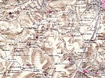
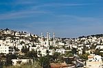
The Jerusalem corridor (Hebrew: פרוזדור ירושלים, Prozdor Yerushalayim) is an area between Jerusalem and the Shephelah in Israel. Its northern border is the old road to Jerusalem; its southern border, the Elah Valley; and its western border, Sha'ar HaGai/Bab el-Wad and the road to Beit Shemesh. The largest towns in the Jerusalem corridor are Beit Shemesh, Mevasseret Zion, Abu Ghosh, Tzur Hadassah and Kiryat Ye'arim.
Excerpt from the Wikipedia article Jerusalem corridor (License: CC BY-SA 3.0, Authors, Images).Jerusalem corridor
Ayelet Hen, Mate Yehuda Regional Council
Geographical coordinates (GPS) Address Nearby Places Show on map
Geographical coordinates (GPS)
| Latitude | Longitude |
|---|---|
| N 31.7833 ° | E 35.1 ° |
Address
איילת חן
Ayelet Hen
Mate Yehuda Regional Council
Jerusalem District, Israel
Open on Google Maps


