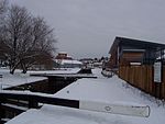
Diglis Basin
Geography of Worcester, EnglandTourist attractions in Worcester, EnglandTransport in Worcester, EnglandUse British English from February 2018Worcester and Birmingham Canal

Diglis Basin is a canal basin on the Worcester and Birmingham Canal. It is situated in Diglis in the centre of Worcester, England, near The Commandery (a command post during the English Civil War). To the north is Tibberton (8.41 miles and 14 locks away) and to the west is Diglis Junction (0.25 miles and 2 locks to the west) where the canal meets the River Severn. It is the first basin (with associated amenities) reached after joining the canal from the River Severn.
Excerpt from the Wikipedia article Diglis Basin (License: CC BY-SA 3.0, Authors, Images).Diglis Basin
Armstrong Drive, Worcester, England Diglis
Geographical coordinates (GPS) Address Nearby Places Show on map
Geographical coordinates (GPS)
| Latitude | Longitude |
|---|---|
| N 52.1834 ° | E -2.2206 ° |
Address
Water Reach
Armstrong Drive
WR1 2GJ Worcester, England, Diglis
England, United Kingdom
Open on Google Maps


