High Offley
Borough of StaffordCivil parishes in StaffordshireVillages in Staffordshire

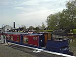
High Offley is a small village and civil parish in Staffordshire, England. It lies 3 miles southwest of the small town of Eccleshall and about 1 mile west of the village of Woodseaves, both on the A519. Woodseaves is the largest settlement in the parish, which also includes the hamlet of Shebdon to the WSW of High Offley, as well as a number of scattered houses and small farms (such as on Grub Street). The Shropshire Union Canal runs through the parish, to the southwest of the villages of High Offley and Woodseaves, with the Shebdon aqueduct and wharf in the west of the parish, from Shebdon towards Knighton.
Excerpt from the Wikipedia article High Offley (License: CC BY-SA 3.0, Authors, Images).High Offley
Grub Street,
Geographical coordinates (GPS) Address Nearby Places Show on map
Geographical coordinates (GPS)
| Latitude | Longitude |
|---|---|
| N 52.8325 ° | E -2.32231 ° |
Address
Grub Street
Grub Street
ST20 0ND
England, United Kingdom
Open on Google Maps


