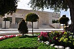
Solomon's Pools

Solomon's Pools (Arabic: برك سليمان, romanized: Burak Sulaymān, or in short el-Burak, 'the pools'; Hebrew: בריכות שלמה, romanized: Breichot Shlomo) are three ancient reservoirs located in the south-central West Bank, immediately to the south of al-Khader, about 3.5 kilometres (2.2 mi) southwest of Bethlehem, near the road to Hebron. The pools are located in Area A of the West Bank under the control of the Palestinian National Authority.Solomon's Pools provided the water for two aqueducts that delivered water to Jerusalem during the late Second Temple period. The first one, known as the "Low-level Aqueduct," is thought to have been built in the first century BCE, around the end of the Hasmonean period. It delivered water to cisterns located underground beneath the Temple Mount, which were primarily used by the Temple. A second aqueduct, the "High-Level Aqueduct," took a similar path, but it is uncertain where it ended up in Jerusalem. It might have provided water to Herod's Palace. The Herodium also received water from the Solomon's Pools.
Excerpt from the Wikipedia article Solomon's Pools (License: CC BY-SA 3.0, Authors, Images).Solomon's Pools
Sulyman Pools Road,
Geographical coordinates (GPS) Address Nearby Places Show on map
Geographical coordinates (GPS)
| Latitude | Longitude |
|---|---|
| N 31.689583333333 ° | E 35.167527777778 ° |
Address
Sulyman Pools Road
Sulyman Pools Road
, Deheisheh Refugee Camp
Palestinian Territories
Open on Google Maps


