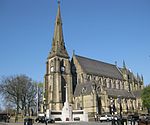
County Borough of Bury

Bury was a local government district centred on Bury in the northwest of England from 1846 to 1974. Under the Bury Improvement Act 1846 a board of twenty-seven improvement commissioners was formed for Bury. The Improvement Commissioners District was enlarged in 1872. A charter of incorporation dated 9 September 1876 created the town a municipal borough and it was further extended in 1885.Under the Local Government Act 1888 Bury was constituted a county borough. This meant that it was independent of Lancashire County Council, exercising both the powers of a borough and county council. However, Bury remained in Lancashire for judicial and other purposes such as lieutenancy and shrievalty. The county borough was extended in 1911 when it gained the Warth area from Radcliffe Urban District and in 1933 when it absorbed much of the dissolved Bury Rural District.The County Borough of Bury was abolished by the Local Government Act 1972 and its territory transferred to Greater Manchester to form the central part of the Metropolitan Borough of Bury.
Excerpt from the Wikipedia article County Borough of Bury (License: CC BY-SA 3.0, Authors, Images).County Borough of Bury
Spring Street,
Geographical coordinates (GPS) Address Nearby Places Show on map
Geographical coordinates (GPS)
| Latitude | Longitude |
|---|---|
| N 53.59 ° | E -2.29 ° |
Address
Spring Street
Spring Street
BL9 0RW , Gigg
England, United Kingdom
Open on Google Maps


