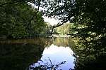
North German Plain

The North German Plain or Northern Lowland (German: Norddeutsches Tiefland) is one of the major geographical regions of Germany. It is the German part of the North European Plain. The region is bounded by the coasts of the North Sea and the Baltic Sea to the north, Germany's Central Uplands (die Mittelgebirge) to the south, by the Netherlands to the west and Poland to the east. In the west, the southern boundary of the North German Plain is formed by the Lower Saxon Hills: specifically the ridge of the Teutoburg Forest, the Wiehen Hills, the Weser Hills and the Lower Saxon Börde, which partly separate it from that area of the Plain known as the Westphalian Lowland. Elements of the Rhenish Massif also act a part of the southern boundary of the plain: the Eifel, Bergisches Land and the Sauerland. In the east the North German Plain spreads out beyond the Harz Mountains and Kyffhäuser further to the south as far as the Central Saxon hill country and the foothills of the Ore Mountains.
Excerpt from the Wikipedia article North German Plain (License: CC BY-SA 3.0, Authors, Images).North German Plain
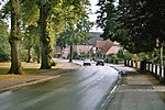
Goethering, Trittau
Geographical coordinates (GPS) Address Nearby Places Show on map
Geographical coordinates (GPS)
| Latitude | Longitude |
|---|---|
| N 53.6 ° | E 10.4 ° |
Address
Goethering 24
22946 Trittau
Schleswig-Holstein, Germany
Open on Google Maps
