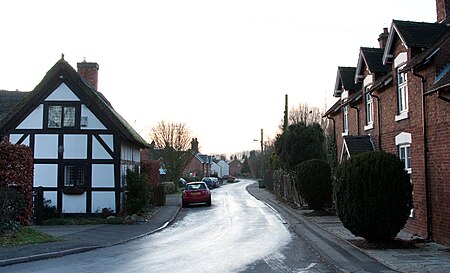
Church Eaton
Borough of StaffordCivil parishes in StaffordshireVillages in Staffordshire

Church Eaton is a village and civil parish in Staffordshire some 6 miles (10 km) southwest of Stafford, 6 miles (10 km) northwest of Penkridge and 4 miles (6 km) from the county boundary with Shropshire. It is in rolling dairy farming countryside. The hamlet of Wood Eaton is northwest of the village. The civil parish also contains Marston to the south and since 1934 has included the hamlet of Apeton to the north.
Excerpt from the Wikipedia article Church Eaton (License: CC BY-SA 3.0, Authors, Images).Church Eaton
Church Eaton Road,
Geographical coordinates (GPS) Address Nearby Places Show on map
Geographical coordinates (GPS)
| Latitude | Longitude |
|---|---|
| N 52.7573 ° | E -2.2217 ° |
Address
Church Eaton Road
Church Eaton Road
ST20 0AE , Church Eaton
England, United Kingdom
Open on Google Maps


