Langley (electoral district)
CanElecResTopTest with bare yearFederal electoral districts in Greater Vancouver and the Fraser ValleyFormer federal electoral districts of British ColumbiaLangley, British Columbia (city)Langley, British Columbia (district municipality) ... and 1 more
Politics of Langley, British Columbia (city)

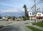
Langley was a federal electoral district in the province of British Columbia, Canada, that was represented in the House of Commons of Canada from 2004 to 2015. It was a 327 km2 in area with 117,858 people located in the suburbs of the Lower Mainland.
Excerpt from the Wikipedia article Langley (electoral district) (License: CC BY-SA 3.0, Authors, Images).Langley (electoral district)
40 Avenue,
Geographical coordinates (GPS) Address Nearby Places Show on map
Geographical coordinates (GPS)
| Latitude | Longitude |
|---|---|
| N 49.072916666667 ° | E -122.56305555556 ° |
Address
40 Avenue
40 Avenue
V2Z 2J9
British Columbia, Canada
Open on Google Maps


