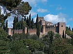
Médio Tejo

The Comunidade Intermunicipal do Médio Tejo (Portuguese pronunciation: [ˈmɛðju ˈtɛʒu]; English: Middle Tagus) is an administrative division in Portugal. It was created in December 2008, replacing the former Comunidade Urbana do Médio Tejo created in 2004. It takes its name from the river Tagus. Médio Tejo is also a NUTS 3 subregion of Centro Region: since January 2015, the NUTS 3 subregion has covered the same area as the intermunicipal community. The seat of the intermunicipal community is Tomar. Médio Tejo comprises parts of the former districts of Santarém and Castelo Branco. The population in 2011 was 247,331, in an area of 3,344.31 square kilometres (1,291.25 sq mi).
Excerpt from the Wikipedia article Médio Tejo (License: CC BY-SA 3.0, Authors, Images).Médio Tejo
Praça do Infante D. Henrique, Tomar
Geographical coordinates (GPS) Address Nearby Places Show on map
Geographical coordinates (GPS)
| Latitude | Longitude |
|---|---|
| N 39.6 ° | E -8.4166666666667 ° |
Address
Mata Nacional dos Sete Montes
Praça do Infante D. Henrique
2300-551 Tomar (Tomar (São João Baptista) e Santa Maria dos Olivais)
Portugal
Open on Google Maps


