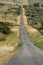
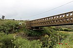
The Golan Heights, or simply the Golan, is a region in the Levant spanning about 1,800 km2 (690 sq mi). The region defined as the Golan Heights differs between disciplines: as a geological and biogeographical region, the term refers to a basaltic plateau bordered by the Yarmouk River in the south, the Sea of Galilee and Hula Valley in the west, the Anti-Lebanon with Mount Hermon in the north and Wadi Raqqad in the east. As a geopolitical region, it refers to the border region captured from Syria by Israel during the Six-Day War of 1967; the territory has been occupied by the latter since then and was subject to a de facto Israeli annexation in 1981. This region includes the western two-thirds of the geological Golan Heights and the Israeli-occupied part of Mount Hermon.
The earliest evidence of human habitation on the Golan dates to the Upper Paleolithic period. After Assyrian and Babylonian rule, the region came under the domination of Persia, and later under the control of Alexander the Great in 332 BCE. The Itureans, an Arab or Aramaic people, settled in the area in the 2nd century BCE. By the third century AD, the Christian Arab Ghassanid kingdom controlled the Golan. The region was later annexed by the Rashidun Caliphate during the Muslim conquest of the Levant in the early seventh century. In the 16th century, the Golan was conquered by the Ottoman Empire. Within Ottoman Syria, the Golan was part of the Syria Vilayet. The area later became part of the French Mandate in Syria and the State of Damascus. When the mandate terminated in 1946, it became part of the newly independent Syrian Arab Republic.
Since the Six-Day War of 1967, the western two-thirds of the Golan Heights has been occupied and administered by Israel, whereas the eastern third remains under the control of Syria. Following the war, Syria dismissed any negotiations with Israel as part of the Khartoum Resolution at the 1967 Arab League summit. Construction of Israeli settlements began in the remainder of the territory held by Israel, which was under a military administration until the Knesset passed the Golan Heights Law in 1981, which applied Israeli law to the territory; the move has been described as an annexation. The Golan Heights Law was condemned by the United Nations Security Council in Resolution 497, which stated that "the Israeli decision to impose its laws, jurisdiction, and administration in the occupied Syrian Golan Heights is null and void and without international legal effect", and Resolution 242, which emphasizes the "inadmissibility of the acquisition of territory by war". Israel maintains it has a right to retain the Golan, also citing the text of Resolution 242, which calls for "secure and recognized boundaries free from threats or acts of force".After the onset of the Syrian Civil War in 2011, control of the Syrian-administered part of the Golan Heights was split between the state government and Syrian opposition forces, with the United Nations Disengagement Observer Force (UNDOF) maintaining a 266 km2 (103 sq mi) buffer zone in between to help implement the Israeli–Syrian ceasefire across the Purple Line. From 2012 to 2018, the eastern half of the Golan Heights became a scene of repeated battles between the Syrian Army, rebel factions of the Syrian opposition (including the United States-backed Southern Front) as well as various jihadist organizations such as al-Nusra Front and the Islamic State of Iraq and the Levant-affiliated Khalid ibn al-Walid Army. In July 2018, the Syrian government regained full control over the eastern Golan Heights.


