Nandrin
Liège geography stubsMunicipalities of Liège ProvincePages with French IPA

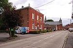
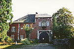
Nandrin (French pronunciation: [nɑ̃dʁɛ̃]) is a municipality of Wallonia located in the province of Liège, Belgium. On January 1, 2006, Nandrin had a total population of 5,539. The total area is 35.90 km2 which gives a population density of 154 inhabitants per km2. The municipality consists of the following districts: Nandrin, Saint-Séverin-en-Condroz, Villers-le-Temple, and Yernée-Fraineux.
Excerpt from the Wikipedia article Nandrin (License: CC BY-SA 3.0, Authors, Images).Nandrin
Chemin des Morts, Nandrin
Geographical coordinates (GPS) Address Nearby Places Show on map
Geographical coordinates (GPS)
| Latitude | Longitude |
|---|---|
| N 50.5 ° | E 5.4166666666667 ° |
Address
Chemin des Morts
Chemin des Morts
4550 Nandrin
Liège, Belgium
Open on Google Maps


