place

Comines-Warneton

Belgium–France border crossingsCities in WalloniaComines-WarnetonDivided citiesEnclaves and exclaves
Municipalities of Hainaut (province)
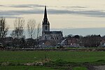
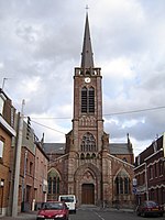
Comines Warneton JPG01

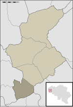
Comines-Warneton (French pronunciation: [kɔmin waʁnətɔ̃] (listen); Dutch: Komen-Waasten, Dutch pronunciation: [ˈkoːmə(n) ˈʋɑːstə(n)] (listen); Picard: Comène-Warneuton; West Flemish: Koomn-Woastn; Walloon: Cômene-Varneton) is a city and municipality of Wallonia located in the province of Hainaut, Belgium. On January 1, 2006, it had a total population of 17,562. Its total area is 61.09 km2 (23.59 sq mi) which gives a population density of 287 inhabitants per square kilometre (740/sq mi). The name "Comines" is believed to have a Celtic, or Gaulish, origin. Comines-Warneton is a municipality with language facilities for Dutch-speakers. The municipality consists of the following districts: Bas-Warneton, Comines, Houthem, Ploegsteert, and Warneton (including the hamlet of Gheer). They were all transferred in 1963 from the arrondissement of Ypres in the Dutch-speaking province of West Flanders to the newly created arrondissement of Mouscron in French-speaking Hainaut. The five municipalities (Comines, Houthem, Ploegsteert, Bas-Warneton, Warneton) were merged into a single Comines-Warneton municipality in 1977. Since then, the municipality forms an exclave of both Hainaut and Wallonia, being surrounded by the Flemish province of West Flanders and the French department of Nord and not connected to the rest of the French-speaking area of Belgium. Comines-Warneton is twinned with Hedge End in England and with Argenton-les-Vallées in France.

Excerpt from the Wikipedia article Comines-Warneton (License: CC BY-SA 3.0, Authors, Images).

Geographical coordinates (GPS)

Latitude Longitude
N 50.766666666667 ° E 3 °
placeShow on map

Address

Centre culturel MJC

Rue des Arts 2
7780
Hainaut, Belgium
mapOpen on Google Maps

Phone number

call+3256561515

Website
cccw.be

linkVisit website

Comines Warneton JPG01
Share experience

Nearby Places

Action on the Polderhoek Spur

The Action on the Polderhoek Spur (3 December 1917), was a local operation in the Ypres Salient, by the British Fourth Army (renamed from the Second Army on 8 November) against the German 4th Army during the Third Battle of Ypres in Belgium during the First World War. Two battalions of the 2nd New Zealand Brigade of the New Zealand Division attacked the low ridge from which German observers could view the ground from Cameron Covert to the north and the Menin road to the south-west. A New Zealand advance of 600 yd (550 m) on a 400 yd (370 m) front, would shield the area north of the Reutelbeek stream from German observers on the Gheluvelt spur further south. Heavy artillery bombarded the ruins of Polderhoek Château and the pillboxes in the grounds on 28 and 30 November as howitzers fired a wire cutting bombardment. The attack on 3 December was made in daylight as a ruse, in the hope that the unusual time would surprise the German defenders, who would be under cover sheltering from the bombardments being fired at the same time each day. The British planned smoke and gas bombardments on the Gheluvelt and Becelaere spurs on the flanks and the infantry attack began at the same time as the "routine" bombardment. The ruse failed; some of the British artillery-fire dropped short on the New Zealanders and the Germans engaged the attackers with small-arms fire from Polderhoek Spur and Gheluvelt ridge. A strong west wind ruined the smoke screens and the British artillery failed to suppress the German machine-guns, which forced the attackers under cover. New Zealand machine-gunners then repulsed a counter-attack by German parties advancing along the Becelaere road. The New Zealanders were 150 yd (140 m) short of the first objective but another attempt after dark was cancelled because of the full moon and sight of German reinforcements reaching Polderhoek Château. On 4 December, German troops assembling for another counter-attack were dispersed by British artillery-fire and German artillery bombarded the captured area all day. The New Zealanders consolidated the new trench line during the night and a German counter-attack at dawn on 5 December was repulsed. The New Zealanders handed over to IX Corps and went into reserve as the Germans used an observation balloon accurately to direct the German guns. A German attack later in the day was stopped by artillery-fire but on 14 December, the ground was re-captured by a German counter-attack.