place

Cowichan Lake

Cowichan Land DistrictCowichan ValleyLakes of Vancouver Island
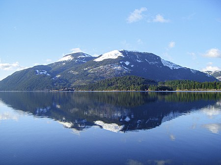
Reflected Peaks Cowichan Lake

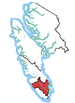
Cowichan Lake is a large freshwater lake located on southern Vancouver Island, British Columbia, Canada. It is located along the Cowichan Valley in the Cowichan Valley Regional District, with its eastern shore about 28 km (17 mi) west of Duncan, British Columbia. Cowichan Lake is about 30 km (19 mi) in length, running mostly from west to east, and is about 4 km (2.5 mi) wide at its widest point. The lake is also the source of the Cowichan River. Cowichan Lake has several communities along its shores. The town of Lake Cowichan is located at the east end of the lake, at the start of the Cowichan River, and is the largest community. Along the south side of the lake are the communities of Mesachie Lake and Honeymoon Bay, and also Gordon Bay Provincial Park. On the north shore is the community of Youbou. The Cowichan Valley was once a thriving lumber centre in British Columbia. In the past, two major railroads had spur lines to and around parts of the lake. With the change in the logging industry, these rail lines have now been abandoned by the railroads and are now part of a major public trail system which leads eastward toward the lower end of the Cowichan Valley. The lake area is largely undeveloped because of the extensive logging by timber companies holding the land surrounding the lake. Currently there are several development projects at new locations around the lake.

Excerpt from the Wikipedia article Cowichan Lake (License: CC BY-SA 3.0, Authors, Images).

Cowichan Lake
Cowichan Valley Trail, Area F (Cowichan Lake South / Skutz Falls)

Geographical coordinates (GPS) Address Nearby Places
placeShow on map

Wikipedia: Cowichan LakeContinue reading on Wikipedia

Geographical coordinates (GPS)

Latitude Longitude
N 48.816666666667 ° E -124.03333333333 °
placeShow on map

Address

Cowichan Valley Trail

Cowichan Valley Trail
V0R 2G0 Area F (Cowichan Lake South / Skutz Falls)
British Columbia, Canada
mapOpen on Google Maps

Reflected Peaks Cowichan Lake
Share experience

Nearby Places

Mesachie Lake

Mesachie Lake is an unincorporated community in the Cowichan Valley region of Vancouver Island, British Columbia, Canada. It lies on the south shore of Cowichan Lake, British Columbia. The name is from the Chinook Jargon for "bad, evil, naughty". It was founded in 1942 by the Hillcrest Lumber Company, which built houses for its workers and their families. This company also planted many non-native fruit and shade trees which have since been given heritage status. In 1942, houses from Sahtlam were cut into pieces and shipped via rail cars and then reassembled in Mesachie Lake with most houses there today having at least part of the original houses still being used. The mill was completely new in design, with more efficient modern equipment. The powerhouse was completed and the generators installed. The powerhouse was able to produce enough power not only for the mill and the community, but on occasion supplied the village of Lake Cowichan when its own plant was overloaded or broken down. In 1982, Camp Imadene bought the old Hillcrest site and moved their camp in a decade later. Mesachie Lake is still a vibrant community, although the school and church have been moved to Lake Cowichan. The Mesachie Skydome is home to many ball tournaments. The community hall hosts various events throughout the year. The town has its own post office and public boat launch. The original Hillcrest Lumber Company office is now a private residence, along with all of the houses once owned by workers at the mill. Mesachie Lake is also one of several towns in the Cowichan Valley with significant South Asian Canadian (primarily Sikh-Canadian) community history for over 130 years, gaining notoriety in the forestry industry at local sawmills from the early 20th century until the 1980s.

Harris Creek Sitka Spruce

The Harris Creek Sitka Spruce is a large Sitka spruce tree, about 4 metres (13 ft) in diameter, near the creek bed of Harris Creek, off the Pacific Marine Road between Port Renfrew, BC and Honeymoon Bay, BC on Vancouver Island, in British Columbia. Although it is not the largest sitka spruce on Vancouver Island, it is easily accessible and has become a famous tree along the Pacific Marine Loop going from Victoria, BC, through Port Renfrew, Lake Cowichan, and Duncan, BC and returning to Victoria over the Malahat Drive (a portion of the Trans-Canada Highway). It is approximately 80 metres (260 ft) tall. The Pacific Marine Road runs along Harris Creek for part of its way between Port Renfrew and Honeymoon Bay. There is a small sign for the tree on the right-hand side of the road, when driving northeast, about 20 kilometres (12 mi) from Port Renfrew, or 8 kilometres (5.0 mi) from Lizard lake. There is enough area to pull over and park, and a short, wheelchair-accessible path leads to the tree. The tree is easily accessible due to the paving a logging road (now part of Pacific Marine Road). It has become well-known: hikers going by on the Harris Creek Main trail are recommended by trail guide books to make a short detour to visit it. The tree is in a second growth forest and is much taller than the surrounding trees. The original old-growth forest was first logged in the 1893, yet this individual tree was spared. The tree is very large at the base as it flares out above ground into the root system. Many of its branches are covered in moss. The tree is surrounded by a fence to protect its root system from excessive trampling. Logging in this area was permanently restricted by a 2012 vote. Two groves of large, gnarly western red cedar trees, known as the Avatar Grove, are also nearby, closer to Port Renfrew.