place

Colvin Run Mill

Fairfax County, Virginia geography stubsFairfax County in the American Civil WarGrinding mills on the National Register of Historic Places in VirginiaIndustrial buildings completed in 1811Mill museums in Virginia
Museums in Fairfax County, VirginiaNational Register of Historic Places in Fairfax County, VirginiaNorthern Virginia Registered Historic Place stubsParks in Fairfax County, VirginiaTextile mills in the United StatesVirginia municipal and county parksVirginia museum stubsWatermills in the United States
Colvin Run Mill
Colvin Run Mill

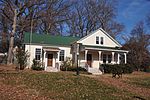
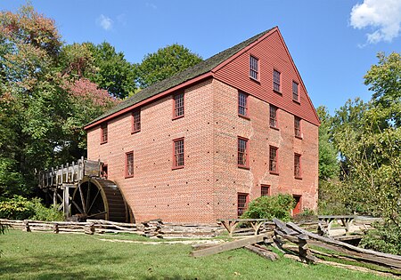
Colvin Run Mill is in Great Falls, Virginia. Built c. 1811, Colvin Run Mill is the sole surviving operational 19th-century water-powered mill in the Washington, D.C. metropolitan area, and its restored mechanism is a nationally significant example of automated technologies pioneered in milling and later adopted across American industry. Down the gravel path of the park is the miller's house, home to the families who ran the mill. In 1883, Addison Millard moved his family here when he bought the old mill. Addison, his wife Emma, and some of their 20 children lived there. When Addison died, the family stayed and operated the mill until 1934. In the mid-1930s the mill was abandoned, and highway development caused it to be cut off from any near-by water source. The mill was later acquired by the Fairfax County Park Authority, repaired, and made open to the public.

Excerpt from the Wikipedia article Colvin Run Mill (License: CC BY-SA 3.0, Authors, Images).

Colvin Run Mill
Nature Trail,

Geographical coordinates (GPS) Address Nearby Places
placeShow on map

Wikipedia: Colvin Run MillContinue reading on Wikipedia

Geographical coordinates (GPS)

Latitude Longitude
N 38.968888888889 ° E -77.293888888889 °
placeShow on map

Address

Blacksmith Shop

Nature Trail
22066
Virginia, United States
mapOpen on Google Maps

Colvin Run Mill
Colvin Run Mill
Share experience

Nearby Places

Washington–Baltimore metropolitan area

The Washington–Baltimore metropolitan area is a combined statistical area consisting of the overlapping labor-market region of the cities of Washington, D.C., and Baltimore, Maryland. The region includes Central Maryland, Northern Virginia, three counties in the Eastern Panhandle of West Virginia, and one county in South Central Pennsylvania. It is the most educated, highest-income, and fourth-largest combined statistical area in the United States.Officially, the area is designated by the Office of Management and Budget (OMB) as the Washington–Baltimore–Arlington, DC–MD–VA–WV–PA Combined Statistical Area. It is composed primarily of two major Metropolitan Statistical Areas (MSAs): the Washington–Arlington–Alexandria, DC–VA–MD–WV MSA and the Baltimore–Columbia–Towson, MD Metropolitan Statistical Area. In addition, five other smaller urban areas not contiguous to the main urban area but having strong commuting ties with the main area are included in the metropolitan area. These are: the Hagerstown–Martinsburg, MD–WV MSA, the Chambersburg–Waynesboro, PA MSA, the Winchester, VA–WV MSA, the California–Lexington Park, MD MSA, and the Easton, MD micropolitan statistical area (µSA). Some counties, such as Caroline and King George County, Virginia, are not officially designated by the OMB as members of this metropolitan area, but still consider themselves members anyway. This is mostly due to their proximity to the area, the size of their commuter population, and by the influence of local broadcasting stations. The population of the entire Washington–Baltimore Combined Statistical Area as of the Census Bureau's 2020 data is 9,973,383. The most populous city is Washington, D.C., with a population of 689,545. The most populous county is Fairfax County, Virginia, with a population of 1,150,309.