place

Baltimore City Hall

1875 establishments in MarylandBaltimore City LandmarksCity and town halls in MarylandCity and town halls on the National Register of Historic Places in MarylandCrimes in Baltimore
Downtown BaltimoreGovernment buildings completed in 1875Historic American Buildings Survey in BaltimoreRenaissance Revival architecture in Maryland
Baltimore City Hall crop

Baltimore City Hall is the official seat of government of the City of Baltimore, in the State of Maryland. The City Hall houses the offices of the Mayor and those of the City Council of Baltimore. The building also hosts the city Comptroller, some various city departments, agencies and boards/commissions along with the historic chambers of the Baltimore City Council. Situated on a city block bounded by East Lexington Street on the north, Guilford Avenue (formerly North Street) on the west, East Fayette Street on the south and North Holliday Street with City Hall Plaza and the War Memorial Plaza to the east, the six-story structure was designed by the then 22-year-old new architect, George Aloysius Frederick (1842–1924) in the Second Empire style, a Baroque revival, with prominent Mansard roofs with richly-framed dormers, and two floors of a repeating Serlian window motif over an urbanely rusticated basement.

Excerpt from the Wikipedia article Baltimore City Hall (License: CC BY-SA 3.0, Authors, Images).

Baltimore City Hall
East Saratoga Street, Baltimore Downtown

Geographical coordinates (GPS) Address Nearby Places
placeShow on map

Wikipedia: Baltimore City HallContinue reading on Wikipedia

Geographical coordinates (GPS)

Latitude Longitude
N 39.290861111111 ° E -76.610694444444 °
placeShow on map

Address

Business and Government Historic District

East Saratoga Street
21202 Baltimore, Downtown
Maryland, United States
mapOpen on Google Maps

Baltimore City Hall crop
Share experience

Nearby Places

Baltimore City Circuit Courthouses

The Baltimore City Circuit Courthouses are state judicial facilities located in downtown Baltimore, Maryland. They face each other in the 100 block of North Calvert Street, between East Lexington Street on the north and East Fayette Street on the south across from the Battle Monument Square (1815-1822), which held the original site of the first colonial era courthouse for Baltimore County (third county courthouse after previous locations / county seats in old Baltimore village on the Bush River and later Joppa) and Town, after moving the Baltimore County seat in 1767 to the burgeoning port town on the Patapsco River established in 1729-1730. The first courthouse in Baltimore Town was built in 1767 and also later housed briefly for a decade the new United States federal courts in the city, after the ratification and operation of the new Constitution in 1789. On July 28, 1776, it was the site for the public reading of the Declaration of Independence, just previously approved by the Second Continental Congress on behalf of the Thirteen Colonies, now United States of America, meeting at the old Pennsylvania State House (now Independence Hall) three weeks earlier in Philadelphia and read out loud to a gathering of Baltimore Town citizens. It was undercut in 1784 by local builder/contractor Leonard Harbaugh with a pair of arched stone/brick arched piers and raised stone foundation to permit extension of Calvert Street to the north by passing traffic underneath at a lower level. This town/county courts structure was torn down around 1800, leaving an empty small square for fifteen years.A second city/county courthouse of Georgian and Federal style architecture in red brick and limestone trim with a cupola was constructed to the west of old Courthouse Square (later renamed Battle Monument Square in honor of the monument raised for remembering local casualties from the British attack in September 1814 during the Battle of Baltimore during the War of 1812). It was sited on the southwest corner of North Calvert and facing north towards East Lexington Street, completed in 1805. This second City/County Courthouse (which also served the small federal district court and judges chambers for 15 years until 1820, when they were relocated into one wing of the huge massive H-shaped Merchants Exchange building capped with a low dome at South Gay and East Lombard Streets, designed and completed that year by famous British-American architect Benjamin Latrobe) was partially burned on 13 February 1835 during a spate of mysterious arson fires in the city during the bank riots that year, but it was soon repaired. An adjacent Egyptian style masonry building to the west along Saint Paul Street was constructed for a Records Office. It was razed around 1896 along with the other structures on the block to its south and west.A third and current courthouse, was built 1896–1900, on the entire city block west of the 1815-1822 Battle Monument. It is bounded by North Calvert Street on the east, East Lexington Street on the north, East Fayette Street on the south and St. Paul Street on the west. A small federal district courthouse and United States Post Office of white marble and limestone was constructed on the northwest corner of East Fayette and North Street (later renamed Guilford Avenue) in 1860 for the federal offices relocated from the one wing of the 1820 Merchants Exchange and was dedicated by 15th President James Buchanan and served only 29 years until 1889. Then it was replaced by a much larger structure with a clock tower and eight massive chimneys facing to the west on Calvert Street and the Battle Monument, occupying the rest of the entire block between Calvert, Lexington, North (Guilford) and Fayette Streets. That Federal courts and central city Post Office on Calvert Street was replaced after only forty years of use in 1932, during the administration of 31st President Herbert C. Hoover which served for the next four decades until replaced by the current Edward A. Garmatz U.S. Courthouse at West Lombard and South Hanover / Liberty Street/Hopkins Place structure adjacent to the 1960s era Charles Center downtown redevelopment project. The old Hoover era federal courts and post office was then transferred to the city by the federal government in 1977 for its use and renovated with being renamed Courthouse East. Today the two historic main structures of the Maryland state judicial system in the City of Baltimore are the Clarence M. Mitchell Jr. Courthouse of 1896-1900 and Elijah E. Cummings Courthouse (the former Baltimore Post Office and U.S. Courthouse of 1932). Together they house the 30 judges of the 8th Judicial Circuit for the State of Maryland (Circuit Court of Maryland for Baltimore City). In addition to the criminal, civil and family (formerly orphans court) courts, these two courthouses also contain the Office of the State's Attorney for Baltimore City, the Clerk of the Circuit Court, the historic Baltimore City Bar Law Library, the City Sheriff's Office, the recently established Baltimore Courthouse and Law Museum (in the former Orphans Court chambers), the Pretrial Release Division of the Maryland Department of Public Safety and Correctional Services, several pretrial detention lockups, jury assembly rooms, land records, court medical offices and Masters hearing rooms.

Battle Monument
Battle Monument

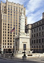
The Battle Monument, located in Battle Monument Square on North Calvert Street between East Fayette and East Lexington Streets in Baltimore, Maryland, commemorates the Battle of Baltimore with the British fleet of the Royal Navy's bombardment of Fort McHenry, the Battle of North Point, southeast of the city in Baltimore County on the Patapsco Neck peninsula, and the stand-off on the eastern siege fortifications along Loudenschlager and Potter's Hills, later called Hampstead Hill, in what is now Patterson Park since 1827, east of town. It honors those who died during the month of September 1814 during the War of 1812. The monument lies in the middle of the street and is between the two Baltimore City Circuit Courthouses that are located on the opposite sides of North Calvert Street. It was sponsored by the City and the "Committee of Vigilance and Safety" led by Mayor Edward Johnson and military commanders: Brig. Gen. John Stricker, Maj. Gen. Samuel Smith and Lt. Col. George Armistead (of Fort McHenry). The site of the former first Baltimore County and Town/City Courthouse (torn down in 1809) was originally designated as the location for the newly planned Washington Monument. Designed by Robert Mills (1781–1855), the cornerstone of the Washington Monument for Baltimore had just been laid on Independence Day, July 4, 1815. But fears that the designed shaft of the column would be too tall for the smaller open space of the old Courthouse Square, and might fall over onto nearby close-in townhouses, caused a last-minute change in location. The monument site for the nation's first president was moved further north of the city into "Howard's Woods" of the "Belvindere" estate of Col. John Eager Howard (1752–1827). The monument, designed by Baltimore architect J. Maximilian M. Godefroy (sculptor to the Court of Spain) and built in 1815–25, is 39 feet (11.9 m) tall. The base of the monument is an Egyptian Revival cenotaph. It is an unusually democratic monument for the time in that it records the names of all who died, regardless of rank. The eighteen layers of the marble base represent the eighteen states that made up the United States at the time of the war. A griffin is at each corner of the base. The column, carved as a Roman fasces, is bound with cords listing the names of soldiers who died during the battle, while the names of officers who died are at the top.The monument is topped by an 8 feet tall 2,750 pound Carrara marble statue by Antonio Capellano of a female figure representing the City of Baltimore wearing a crown of victory, holding a laurel wreath in one hand and a ship's rudder in the other. It was hoisted to the top of the column during the middle of the period of construction on the eighth anniversary ceremonies, Defenders Day, September 12, 1822. Colloquially called Lady Baltimore, the statue was relocated to the Maryland Historical Society on October 5, 2013, in order to preserve it from further damage caused by time and nature. It was replaced by a concrete replica. The monument is the oldest stone monument and first public war memorial in the United States.The monument is depicted on the seal of the City of Baltimore that was adopted in 1827 and the city's flag adopted in the early 20th century. The monument is erroneously depicted as being in Washington, D.C. in the 2007 film Live Free or Die Hard starring Bruce Willis, which had numerous scenes actually filmed in downtown Baltimore. The Battle Monument was placed on the National Register of Historic Places on June 4, 1973. It is contained within the Business and Government Historic District and is within the Baltimore National Heritage Area.

The Block, Baltimore

Baltimore's The Block is a stretch on the 400 block of East Baltimore Street in Baltimore, Maryland, containing several strip clubs, sex shops, and other adult entertainment merchants. During the 19th century, Baltimore was filled with brothels, and in the first half of the 20th century, it was famous for its burlesque houses. It was a noted starting point and stop-over for many noted burlesque dancers, including the likes of Blaze Starr. By the 1950s, the clubs became seedier, as burlesque was replaced by strip clubs and sex shops. The Block of that era is featured prominently in several films, notably Barry Levinson's Liberty Heights and Diner, as well as Steve Yeager's independent feature drama On The Block, with Howard Rollins.The decades to follow would bring a marked increase in general crime, sex work, and drug dealing, an unusual situation considering the location of Baltimore's Police Headquarters and Central Police District House at the east end of the block. It has been suggested that the police, whose headquarters are located right next to The Block, chose to contain the prostitution and drug dealing in that small section of Baltimore rather than combat it.The passing decades would see a shrinking of the area. Once several blocks long, stretching almost to Charles Street in the central part of downtown Baltimore, today The Block only stretches about two blocks long from South Street to Gay Street.Polock Johnny's sausage restaurant was a local landmark on the strip into the 1980s. In recent years, The Block has undergone a bit of a revival with the opening of Larry Flynt's Hustler Club, and its next-door neighbor Norma Jean's, an upscale urban strip club.A five alarm fire on December 6, 2010, heavily damaged four buildings, including the building that formerly housed the Gayety Theater. The fire was believed to be an act of arson.

Canton House
Canton House

Canton House is a historic office building located on the northeast corner of Water Street and South Street in Baltimore, Maryland, United States. It is a 4+1⁄2-story Colonial Revival-style building, with seven bays across the front façade of Water Street to the south and three bays across the side facing South Street to the west. The first story level is in marble and brick is laid in Flemish bond from the second story up. It has a sloped peaked roof with two dormer windows facing west to the side. The main entrance features two fluted Corinthian stone columns. It was constructed in 1923 as the headquarters of one of Baltimore's oldest, largest and most colorful businesses, The Canton Company, a business established in 1828 by Peter Cooper (1791-1883), noted engineer and industrialist most remembered for inventing and manufacturing the Tom Thumb steam locomotive for the recently established Baltimore and Ohio Railroad, the first passenger railway line in America in 1827 as it made its transition from using horse power to steam power to pull its railroad cars on the first segment of the line from Baltimore southwest to Ellicott Mills, Maryland on the upper Patapsco River from Helen Delich Bentley Port of Baltimore. Columbus O'Donnell, the son of John O'Donnell, a sea captain who brought in the first trade cargos from Canton, China to Baltimore and America in 1784, along with William Patterson (1752-1835), a noted city merchant, civic leader, co-founder of the Baltimore and Ohio Railroad and the father of the infamous Elizabeth ("Betsy") Patterson Bonaparte, the "Belle of Baltimore", who married Jerome Bonaparte on Christmas Eve, December 24, 1803, the younger brother of the French Emperor Napoleon I and the donater of land for nearby Patterson Park in 1827. The company was established to develop the industrial, commercial and residential potential of the large tract of land along the north shore of the Patapsco's Northwest Branch, east of the Inner Harbor (then called "The Basin") and southeast of old Baltimore Town and neighboring Fells Point, Baltimore The Canton House was listed on the National Register of Historic Places in 1978.